



Weather Headlines:
- The Extreme Heat Warning for the deserts lasts until 8pm Friday
- Above-normal temperatures last through Friday
- Elevated surf and high tides may bring coastal flooding and beach erosion
- 20 to 40 degrees cooler by Monday
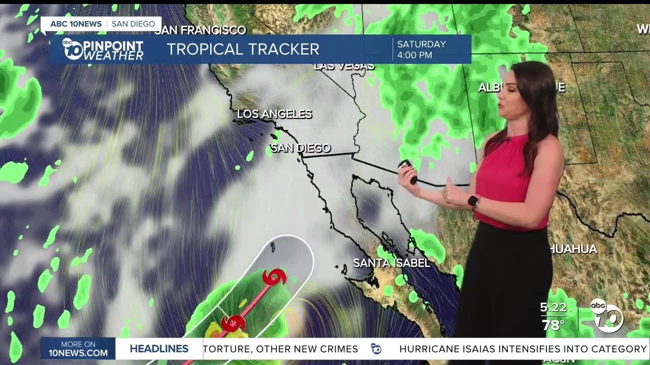
- Tropical Storm Rachel will bring the chance of heavy rain and thunderstorms Saturday night through Sunday (dependent on track of Rachel)
- A Pacific storm will bring scattered light to moderate showers Monday into Tuesday morning.
- Strong winds are expected on Sunday, remaining gusty into Monday.
While it won't be as hot, temperatures will remain 5 to 10 degrees above normal on Friday. An Extreme Heat Warning continues until 8pm Friday for the deserts.
Temperatures plummet anywhere from 20 to 40 degrees from the heat we've been feeling by Monday as a storm to the north pushes the high-pressure heat dome to the east.
This weekend you can expect 70s at the coast, 80s inland on Saturday dropping to the 70s on Sunday, 70s in the mountains on Saturday dropping to the 60s and 50s Sunday into next week, and 90s in the deserts Saturday, 80s on Sunday and 70s on Monday. These temperatures will be 5 to 20 degrees below average, a stark difference from the 20 to 30-degree above-normal temperatures we felt this week!
That Pacific storm will drop the jet stream south, steering Tropical Storm Rachel north into Baja and eventually Southern California and Arizona. This will bring a chance of rain and thunderstorms from Rachel Saturday night through Sunday, while the Pacific storm will bring scattered showers Monday into Tuesday morning.
The amount of rain we see depends on several factors, including how far south the Pacific storm dives and where Rachel actually tracks. If she tracks farther west we could see widespread heavy rain and possible flooding; if she tracks farther east we won't see as much rain.
This is a situation where you want to prepare for the worst and hope for the best. Periods of heavy rain are possible Saturday night into Sunday, while light to moderate scattered showers are expected Monday into Tuesday.
Forecast rainfall totals:
The most likely rainfall totals as of Thursday for the coast and valleys will be between .50 to .75", 1 to 2" in the mountains, and .50 to 1" in the deserts. However, a worst-case scenario could bring an inch of more to the coast and inland areas.
Rainfall totals for Monday and Tuesday will average between .25 to .50" for the coast and valleys, .50 to 1" in the mountains and up to .10" in the deserts.
Wind:
Strong winds will accompany these storms, with strongest winds expected on Sunday with the passing of Rachel, but strength will depend on where Rachel actually tracks. Preliminary wind gusts on Sunday for the coast and valleys will be between 20 to 35mph, 40 to 55mph in the mountains and 40 to 70mph in the deserts. These winds may cause damage, so measures should be taken to secure loose outdoor items, including any holiday decorations.
It will remain gusty into Monday with westerly gusts of 20 to 25mph for the coast and valleys and 35 to 55mph in the mountains and deserts.
Coastal flooding:
Elevated surf from Tropical Storm Rachel and elevated high tides will bring the threat coastal flooding and beach erosion. A Beach Hazards Statement is in effect until 11pm Friday for waves of 3 to 7 feet and dangerous rip currents. A Coastal Flood Advisory has been extended until 2pm Tuesday for possible issues during the morning and evening high tides between 6.5 to 7 feet.
Friday's Highs:
Coast: 75-85°
Inland: 84-93°
Mountains: 79-93°
Deserts: 104-107°
Follow ABC 10News Chief Meteorologist Megan Parry on Facebook at Megan Parry 10News, Instagram @mis_meg_wx and Twitter @10NewsParry.
