




Weather Headlines:
- Periods of rain into early Tuesday morning
- High Surf Advisory until 4am Wednesday
- Gusty winds into Tuesday and again late Wednesday into Thursday ahead of a stronger storm
- Thursday will bring more widespread rain, heavier at times and possible thunderstorms
- Below average temperatures all week
- King Tides next week could bring a greater threat of coastal flooding
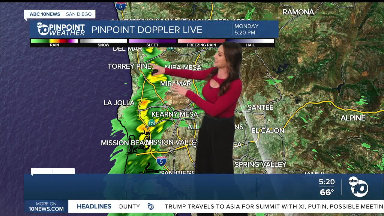
Storm one of the week will bring on-and-off rain mostly Monday night, ending early Tuesday morning. Rainfall will be mostly light to moderate, but brief heavy showers are possible and a slight chance of thunderstorms.
Rainfall totals will average between 0.10 to 0.50" for the coast and valleys, between 0.40 to 1" in the mountains and little to no rain expected in the deserts.
Gusty winds will continue into Tuesday, mostly in the mountains and deserts, with westerly gusts of 25 to 50mph while the coast and valleys will be breezy with gusts up to 25mph.
A High Surf Advisory is in effect until 4am Wednesday for large waves of 6 to 10 feet and dangerous rip currents. High tides are lower than they have been, but with the bigger waves it's possible to see minor coastal flooding during high tides. Surf is expected to build again Thursday as the next storm moves in.
King Tides next week are expected to top out near 8 feet when they peak, and may bring a greater threat of coastal flooding. Tides may exceed 7 feet as early as Saturday.
Most of Tuesday and Wednesday will be dry with mostly sunny to partly cloudy skies. Temperatures will trend near to up to 15 degrees below average all this week, with 60s for most coast and valleys, 40s and 50s in the mountains and 70s in the deserts.
A stronger storm will bring more widespread and heavier rain Thursday with a few showers lingering into Friday morning. Gusty winds will accompany this storm along with a slight chance of thunderstorms. Westerly gusts of 25 to 55mph are expected in the mountains and deserts with gusts up to 15 to 30mph for the coast and valleys.
Rainfall totals will likely be around 1 inch for most of the county with Thursday's storm, with much lighter totals in the deserts. This storm will be colder with a possible light dusting of snow by Friday morning for the higher mountains of Mt. Laguna and Palomar Mountain.
Tuesday's Highs:
Coast: 65-60°
Inland: 60-69°
Mountains: 44-57°
Deserts: 70-74°
Follow ABC 10News Chief Meteorologist Megan Parry on Facebook at Megan Parry 10News, Instagram @mis_meg_wx and Twitter @10NewsParry.
