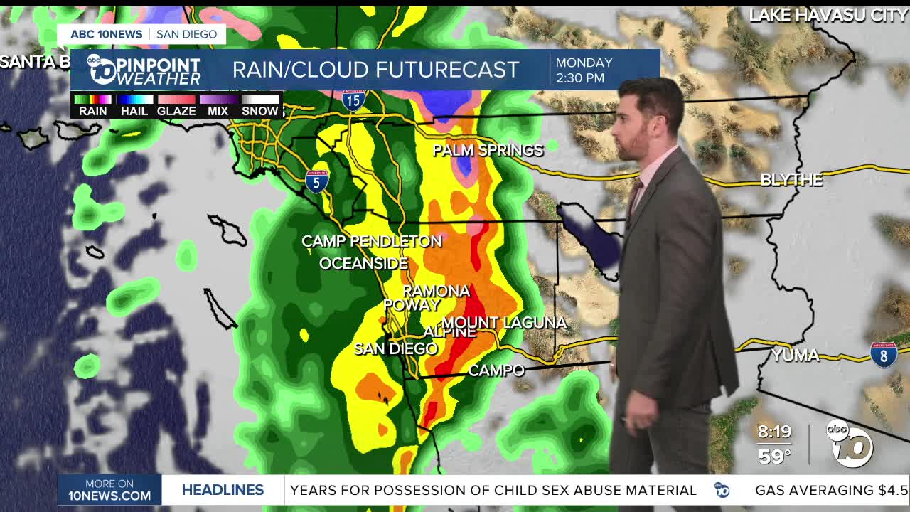


SAN DIEGO (KGTV) — Periods of rain, wind, and mountain snow are expected Monday through Thursday. There is a slight chance of thunderstorms late Monday afternoon through early Tuesday morning. Lower elevation snow is possible Wednesday evening into Thursday, potentially as low as 3,500 feet Wednesday night. Chances of precipitation decrease Thursday into the weekend.
Key Points:
- A winter storm will bring widespread heavy snow to the mountains above 6,000 feet creating hazardous travel conditions Monday through Thursday. Snow levels as low as 3,500 to 4,000 feet Wednesday night may result in light accumulations through the Cajon Pass and along I-8.
- Gusty south to west winds are expected Monday from the coast to the deserts. Stronger and potentially damaging west winds along the mountain crests and adjacent desert slopes Tuesday afternoon through Wednesday.
- Moderate to locally heavy rain is expected below the snow level. Ponding of water on roads and minor street flooding in urban areas possible. Increased flows on rivers, especially the San Diego, Santa Margarita, and Whitewater Rivers.
Areas of low clouds are developing over the coastal basin and should increase in coverage through the morning. Numerous high clouds continue to overspread the region ahead of an upper level low currently off the coast of Northern California. Today will be a few degrees cooler than yesterday with highs near to slightly below normal.
Monday's Highs:
Coast: 63-66°
Inland: 56-66°
Mountains: 52-62°
Deserts: 65-74°
For the latest news, weather and traffic updates, follow Gabe Salazar on Facebook and Instagram.
