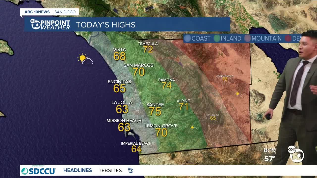


Warm and dry weather will continue through Monday with high temperatures remaining 10 to 15 degrees above normal inland. Patchy fog will continue near the coast and western valleys into early next week.
A low pressure system and associated weak to moderate Atmospheric River will bring widespread heavy rain and high elevation mountain snow late Tuesday into Christmas Day. Shower chances lower to around 50 to 60% on Friday and 20 to 30% on Saturday.
Key Weather Points:
- High temperatures as much as 10 to 15 degrees above normal inland through Monday
- Reduced visibility in fog for the coastal areas and western valleys each night and morning through Tuesday could result in locally hazardous travel conditions
- Widespread moderate to heavy rainfall and gusty southerly winds Christmas Eve and Christmas Day with the potential for roadway flooding, rock and mudslides along mountain highways, and debris flows in and below recent burn scars
- Rapid rises in small streams and increased flow in main stem rivers
- Additional chances of showers Friday and Saturday with lower snow levels, creating slick conditions on mountain highways
Marine layer low clouds have spread into the western valleys this morning with only isolated dense fog being reported in the valleys. Otherwise a few high clouds are moving over the region. Low clouds and fog will clear inland by late morning, but could linger along the coast through the afternoon.
Not much change in the weather over the next three days as the region remains under mostly zonal flow. An upper level high to the south slowly shifts east through Monday, but the end result is little change in heights and flow aloft becoming slightly more southwesterly.
A persistent marine layer with night and morning low clouds and fog for the coastal areas and western valleys will help moderate high temperatures in those areas, while inland areas remain warm. Highs along the coast will be near normal, around 5 to 10 degrees above normal for the valleys and low deserts, and as much as 15 degrees above normal for the lower elevation mountains and high deserts.
A big shift in the weather pattern will occur by midweek. An upper level trough and associated Atmospheric River will amplify off the West Coast. A short wave embedded in the trough lifts into Southern California Tuesday night, ushering in the first surge of moisture and widespread moderate to heavy precipitation.
