

SAN DIEGO (KGTV) — We had a great weekend weather-wise here in San Diego!
Don’t expect the warm and sunny conditions to last too long though- low pressure is moving into California and will bring us some cool and breezy conditions.
As we start the work-week, Monday our coastline will see highs in the mid to upper 60s.
Our inland spots will be warmer, reaching highs in the mid to low 70s.
Our mountains will be topping out in the upper 60s, while the deserts will see temperatures reach the low 90s.
Expect mostly sunny skies across the county, and partly cloudy conditions at the beaches.
Cloud cover will build overnight Sunday, with a deepening marine layer waking us up Monday morning.
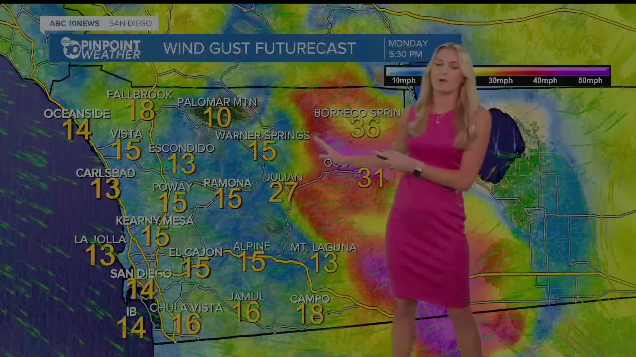
We will see winds get stronger, especially in our mountains and deserts Monday afternoon and evening.
Gusts could reach 30 to 40 mph in wind prone areas!
Looking ahead to this week, we see a slight chance for rain developing overnight into Wednesday, just in time for Earth Day!
Monday's Highs
Coast: 64-69°
Inland Valleys: 71-76°
Mountains: 68-76°
Deserts: 88-93°
Follow ABC 10News Weather Anchor Ava Kershner on Instagram, Facebook, and X.
