

SAN DIEGO (KGTV) — A gray start is expected for many coastal and valley communities as the marine layer continues to bring low clouds and patchy morning drizzle across the county.
The low clouds are expected to push inland overnight and during the morning hours before gradually clearing by late morning and into the afternoon. Most areas will stay dry, but some coastal spots and nearby valleys could see light drizzle at times through the weekend.
Inland communities will be warmer today, with temperatures running above normal under weak high pressure. Coastal areas will stay closer to average because of the marine influence.
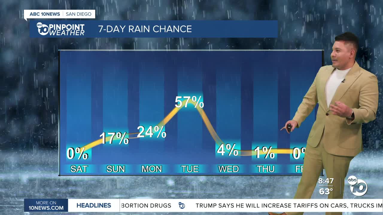
A weather shift arrives late Sunday into Tuesday as a low-pressure system moves across California. That will bring cooler temperatures, stronger onshore flow and a chance for light showers, especially Monday night into Tuesday morning. Rainfall totals are expected to remain light, with most locations staying under 0.15 inches.
Winds will also become a concern, mainly in the mountains and deserts, where gusts could reach 35 to 45 mph. Isolated gusts up to 60 mph are possible in the windiest spots.
By Wednesday, drier weather returns and temperatures begin to climb. The warming trend continues into next weekend, with inland valleys and high deserts likely reaching the 90s and lower deserts possibly climbing into the triple digits.
Saturday's High Temperatures:
Coast: 65–69°
Inland valleys: 76–82°
Mountains: 62–70°
Deserts: 88–96°
