

We tied and set some daytime high records in San Diego County on Veteran's Day, but by Friday, you'll be waking up and wondering if it was all a dream. It's going to look and feel much different by then.
Here's a look at Tuesday's notable temps where we matched or broke records: Ramona (91 - tied), Alpine (89 - tied), Lake Cuyamaca (79 - set), Campo (91 - set).
Temperatures hold on a bit on Wednesday in the mountains and deserts, where you'll remain above average by around 10 degrees. The coast and valleys will be back to and slightly below normal.
Everyone will dip below average by Friday and don't rebound much moving forward.
The daytime high decrease is pretty remarkable. Temperatures will be anywhere from 10-30 degrees cooler when you compare Monday to Saturday.
Wednesday will start on another foggy note for the coast and valleys. Everyone but the desert communities will see mostly cloudy skies.
Thursday will be partly cloudy, but noticeably breezy in the mountains and deserts, where the strongest gusts will climb between 30-40 mph. The valleys and coast will be more in the 20-25 mph range.
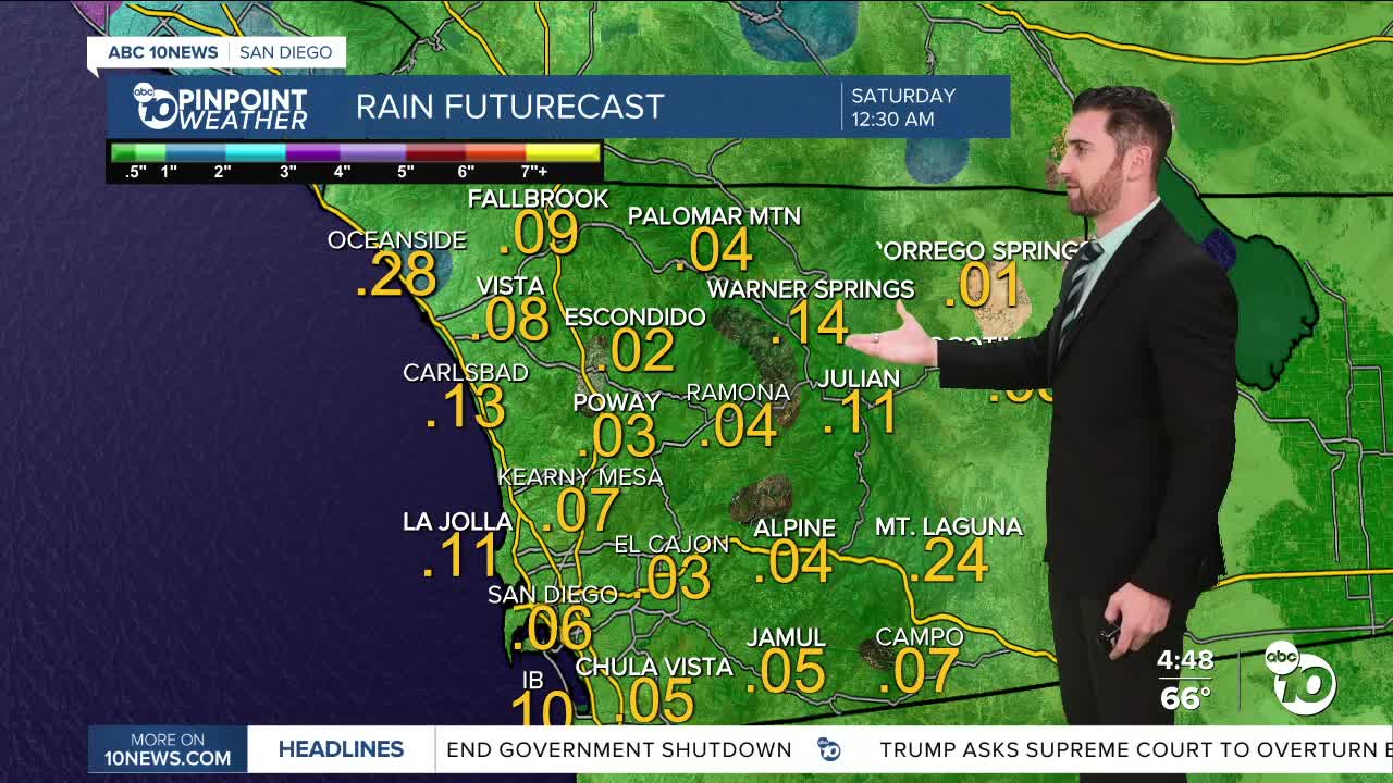
Shower chances begin late Thursday, but really pick up overnight into Friday. We could see some thunderstorms added into the mix as well in and west of the mountains.
Rain chances peak on Friday and Saturday, and stick around into early next week.
The 72-hour rainfall totals (Thursday-Saturday) will mostly likely be more than an inch, and in a few areas more than two inches. That goes for all areas except for the deserts, which will still receive rain but might not quite hit the one-inch mark.
Wednesday's Highs:
Coast: 67-74°
Inland: 74-80°
Mountains: 68-79°
Deserts: 84-89°
Follow ABC 10News Weather Anchor Max Goldwasser on Instagram, Facebook and Twitter.
