

SAN DIEGO (KGTV) — A familiar sight returns across the region as another round of low clouds and gray skies blankets the coast and pushes into the inland valleys.
A deepening marine layer is setting the tone this morning, bringing widespread cloud cover and even the chance for patchy drizzle, especially west of the mountains. While most areas will remain dry, some coastal communities and nearby valleys could wake up to light moisture on the roads.
Conditions are expected to gradually improve through the late morning and into the afternoon, though clouds may linger longer than usual in some areas.
A broader weather shift is now underway as a low-pressure system approaches from the northwest. This system will bring a cooling trend through early next week, along with breezy conditions and increasing cloud cover.
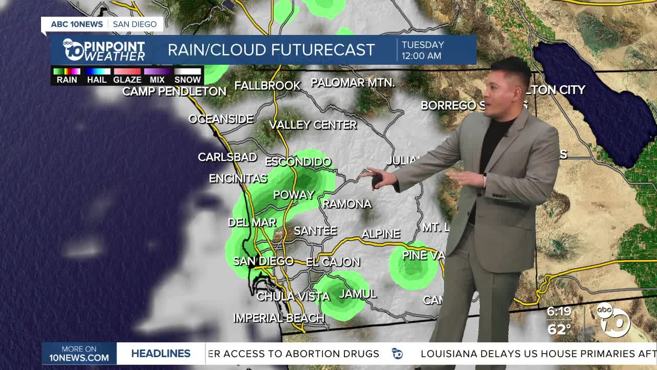
The best chance for measurable rainfall will come in two waves — the first arriving late tonight, followed by a second round Monday night into Tuesday morning. Rainfall totals are expected to stay light overall, with coastal and valley areas seeing only trace amounts, while the mountains could pick up close to a quarter of an inch.
Winds will also increase, particularly in the mountains and deserts. Gusts could reach 35 to 45 mph, with isolated gusts as high as 60 mph in wind-prone areas such as mountain passes.
Temperatures will take a noticeable dip, with Monday and Tuesday shaping up to be the coolest days of the week. Daytime highs will fall below seasonal averages across much of the region.
By midweek, drier conditions return as high pressure begins to build back in. This will kick off a warming trend that continues into next weekend, with inland areas potentially climbing well above normal.
Sunday High Temperatures:
Coast: 64–68°
Inland valleys: 68–74°
Mountains: 48–58°
Deserts: 74–82°
