

If you have any of the outdoor chores to do, today is the day to do them! Thursday is quite literally the calm before the storm, as rain chances pick up tonight and don’t slow down over the next few days.
We will see partly cloudy conditions in our skies today, with the coastline being in the low 70s and upper 60s.
Our inland spots will be in the upper 70s and low 80s.
Our mountains and deserts will see some breezy conditions this afternoon.
Mountains reach highs in the low 70s to upper 60s, and our deserts are in the upper 80s.
This will be the warmest day of the next seven, thanks to this cold storm system causing our temperatures to plummet as the rain chances increase.
Rain chances pick up tonight, and we expect showers lasting through Friday.
About a half of an inch of rain could come from Friday’s totals alone.
Then the heavy rain comes.
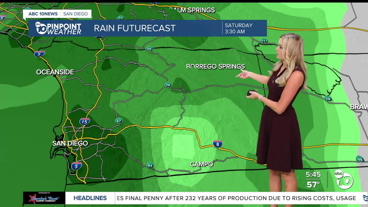
Saturday will see the heaviest amounts of rainfall, and could bring several inches in totals.
We also see thunderstorm chances pick up for Saturday.
The chances for showers linger for a few days, and slowly drop toward Wednesday.
Our coast and valleys could get between 2 to 3 inches from this system, with even more for our mountains. The deserts are projected to get close to 1 inch of rain.
Temperatures are also dropping with this system, with below average conditions lasting through next week.
Comparing this weekend’s temps to the ones we started this week with, we could be seeing a 10 to 30 degree drop!
A major cooldown and potential for lots of rain moving our way, so make sure to be prepared and be extra safe on the roads!
Thursday's Highs:
Coast: 67-72°
Inland: 74-79°
Mountains: 67-75°
Deserts: 86-90°
Follow ABC 10News Weather Anchor Ava Kershner on Instagram, Facebook, and X.
