



Weather Headlines:
- Uncomfortable heat and humidity through Thursday.
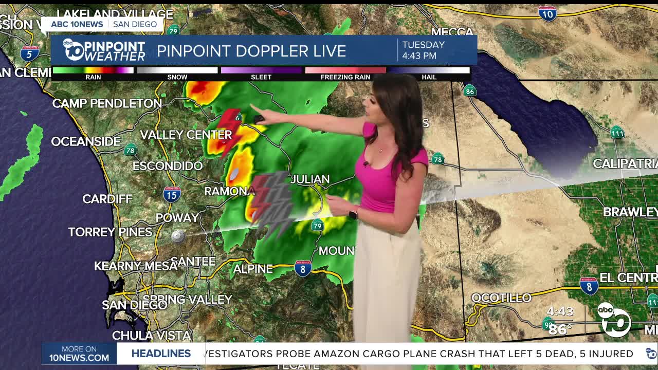
- Showers and thunderstorms each afternoon and evening through Thursday, best chance near the mountains.
- High surf, strong rip currents and possible coastal flooding through Wednesday.
- Extreme Heat Warning for the coast and valleys until 8pm Wednesday, then a Heat Advisory will go into effect until 8pm Thursday.
- Extreme Heat Warning in the deserts Wednesday through Friday.
- Heat Advisory in the mountains through Thursday.
- Cooler and less humid this weekend.
Wednesday will be just as hot and humid as it has been with dangerous beach conditions for another day and showers and thunderstorms over parts of the county.
Tuesday was another record-hot day with Poway soaring to 105 degrees! We'll be close to several records on Wednesday, including in Kearny Mesa, Escondido, Poway, Vista, Chula Vista and San Diego.
This hot and sticky weather will continue through Thursday with the worst of the heat and humidity through Wednesday.
An Extreme Heat Warning is in effect for the coast and valleys until 8pm Wednesday. The coast will experience temperatures between 85 and 97 degrees, and just 5 to 10 miles inland we'll start to see 100s. The inland areas will mostly be near 100 degrees.
When that ends at 8pm, a Heat Advisory will go into effect because it will still be hot, just not as hot as it's been. The Heat Advisory for the coast and valleys will continue through 8pm Thursday. You can expect mid-80s to low-90s at the coast and 90 to 102 inland.
A Heat Advisory is in effect for the mountain communities until 8pm Thursday for 90s bleow 5,500 feet.
An Extreme Heat Warning will be in effect for the deserts Wednesday through Friday for highs up to 112 degrees.
On top of the hot and humid days, the nights won't provide much relief, with warm and muggy nights. Temperatures will only drop to the mid-70s to low-80s for most coast and inland areas by sunrise, low-70s in the mountains and 80s in the deserts. That means you can expect 80s and 90s most of the evening and night for much of the county.
Most rainfall has been light, with heavier rain in thunderstorms. Isoalted to scattered storms are expected again Wednesday and Thursday in the afternoon and evening. Any storms may produce heavy rain, localized flooding, small hail and strong winds.
Click here to see real-time rainfall totals.
The Coastal Flood Advisory has been extended until 11pm Wednesday due to high surf and astronomical high tides leading to the threat of coastal flooding and beach erosion. High tide on Wednesday will be 6.3' at 8:38pm
There is relief in sight, though! Cooler and drier, less humid air is expected this weekend! Temperatures will drop back into the 70s along the coast, 80s inland, 70s and low-80s in the mountains, but still in the 100s in the deserts, but it will be a dry heat!
Fall is right around the corner with the Autumnal Equinox happening at 5:05pm on September 22nd.
Wednesday's Highs:
Coast: 85-97°
Inland: 97-106°
Mountains: 83-99°
Deserts: 108-110°
Follow ABC 10News Meteorologist Megan Parry on Facebook at Megan Parry 10News, Instagram @mis_meg_wx and Twitter @10NewsParry.
