


After a long stretch of hot and humid weather, cooler and drier air is headed our way this week. A trough of low pressure, basically a storm to the north, will push the heat dome east.
The marine layer will produce patchy fog that may be dense at times overnight into Tuesday morning. Clouds will gradually clear to sunny skies with pleasant afternoon temperatures 3 to 10 degrees below normal.
Greater cooling with a deepening marine layer Wednesday and Thursday which may produce mist to patchy drizzle in the overnight and morning hours. Thursday will be the coolest day of the week with highs 5 to 15 degrees below normal. Expect mostly low-70s at the coast, mid to upper-70s inland, 60s in the mountains and 90s in the desert.
The wind will pick up as the trough approaches. A Wind Advisory will be in effect for the mountains and deserts from 2pm Tuesday until 1am Wednesday for southwesterly winds of 15 to 25mph, gusts to 45mph and isolated gusts to 55mph. The coast and valleys can expect wind gusts of 15 to 25mph.
Gradual warming into the weekend, but temperatures will still trend well below average for mid-September. Overall expect sunny skies and pleasant temperatures in the 70s and 80s for most of the county.
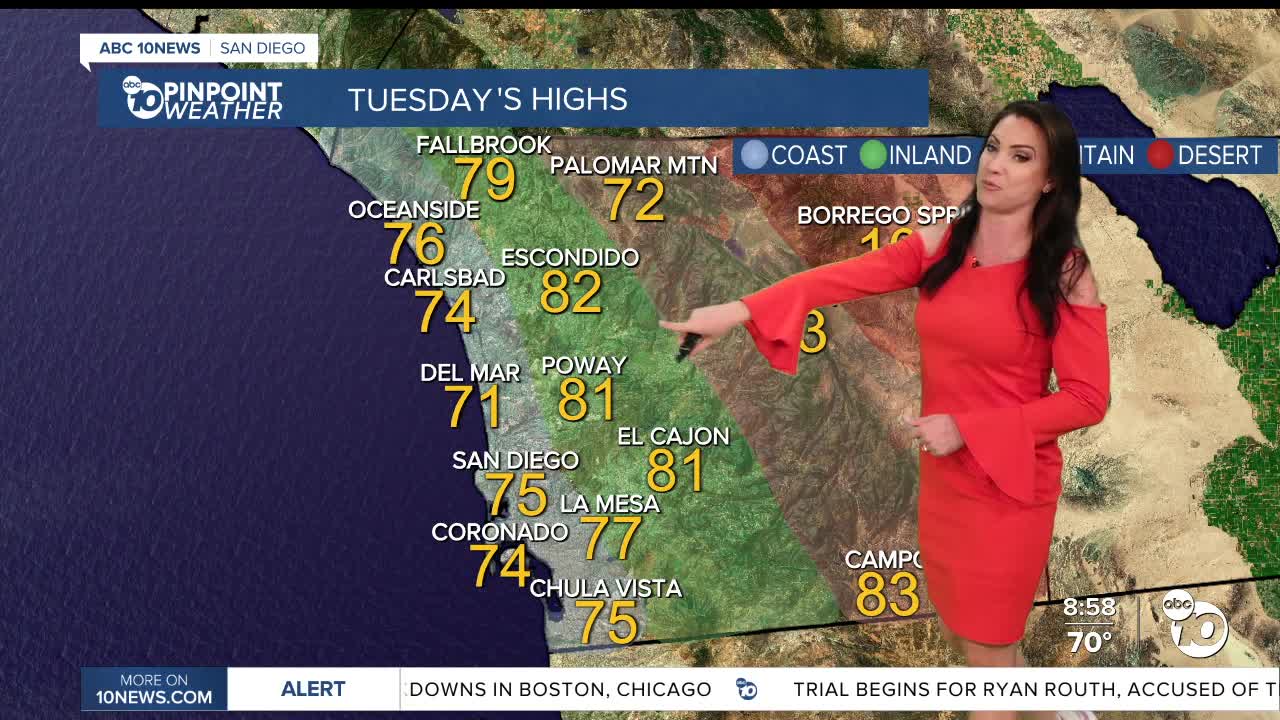
Tuesday's Highs:
Coast: 70-77°
Inland: 77-83°
Mountains: 71-83°
Deserts: 98-102°
Follow ABC 10News Meteorologist Megan Parry on Facebook at Megan Parry 10News, Instagram @mis_meg_wx and Twitter @10NewsParry.
