



Weather Headlines:
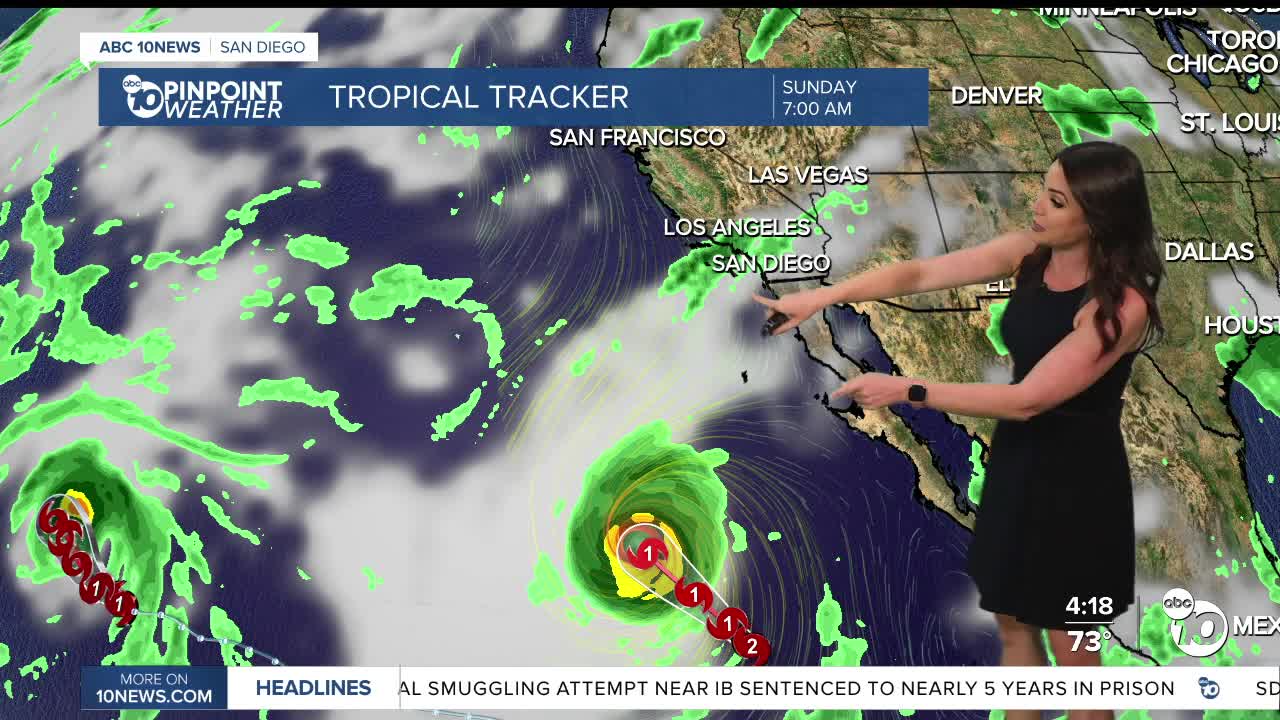
- Higher humidity this weekend as moisture gets pulled in from Hurricane Marie.
- The chance of showers looks less likely this weekend, but isolated showers are still possible late Saturday into Sunday from tropical moisture.
- Large waves and strong rip currents will impact the beaches this Labor Day weekend from Hurricane Marie, creating dangerous beach conditions.
The tropics are active with three hurricanes churning in the Pacific. The one we are keeping an eye on is Hurricane Marie. The latest storm track is taking it farther west and not as far north, which means the chance of rain locally is looking less likely. We'll still have a chance of isolated showers and a slight chance of thunderstorms late Saturday into Sunday, along with big waves at the beaches.
While rainfall timing and totals depend on where Marie actually tracks, it's looking most likely for light totals between a few hundredths of an inch to a quarter of an inch.
A High Surf Advisory and Coastal Flood Advisory will be in effect from 6am Saturday until 11pm Tuesday. Waves of 6 to 10 feet are expected along south and southwest-facing beaches with waves of 4 to 7 feet along west-facing beaches. High surf, high tides and strong rip currents will lead to dangerous swimming conditions this holiday weekend.
On top of the surf, we're expecting astronomical high tides, so coastal flooding and beach erosion will also be possible Saturday through Tuesday, with Monday the greatest chance for impacts as high tides build into mid-week.
High Tide Times:
Saturday: 6 feet at 4:48pm
Sunday: 6.3 feet at 6:03pm
Monday: 6.7 feet at 7:03pm
Tuesday: 6.8 feet at 7:54pm
Stay with the Pinpoint Weather Team for updates on this tropical moisture and possible impacts into the holiday weekend.
It will be warm and muggy this weekend with 70s and 80s along the coast, mid-80s to low-90s inland, mostly 70s in the mountains, while it will be a bit cooler but more humid in the deserts in the 90s.
Warmer next week with more 80s along the coast, low to mid-90s inland, 80s in the mountains and closer to 105 degrees in the deserts. On top of the warmer weather it will remain humid as monsoon moisture returns which may bring a chance of showers and thunderstorms to the mountains and deserts by midweek.
The following weekend may feel more like fall with cooler and drier air moving in!
Saturday's Highs:
Coast: 76-83°
Inland: 82-90°
Mountains: 75-87°
Deserts: 96-99°
Follow ABC 10News Meteorologist Megan Parry on Facebook at Megan Parry 10News, Instagram @mis_meg_wx and Twitter @10NewsParry.
