



Weather Headlines:
- Below average temperatures and lower humidity through Friday.
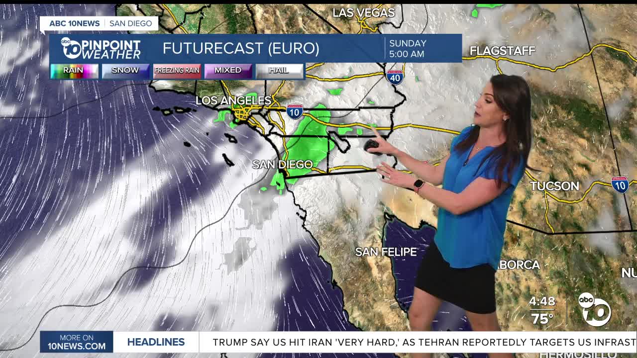
- Higher humidity this weekend as moisture gets pulled in from Tropical Cyclone Marie.
- Possible showers and thunderstorms Saturday through Monday from tropical moisture.
- High uncertainty on rainfall timing and totals, but mostly likely will be light to moderate rain with possible brief heavy showers.
- Large waves and strong rip currents will likely impact the beaches this Labor Day weekend from Tropical Cyclone Marie, creating dangerous swimming conditions.
This cooler and less humid weather will continue through Friday before things turn warm, muggy and potentially wet this weekend as tropical moisture is pulled in from Tropical Cyclone Marie.
Temperatures will trend near to 10 degrees below average through Friday along with comfortable humidity levels. You can expect 70s and 80s for most of the county and low-100s in the deserts.
The tropics are active with three tropical cyclones churning in the Pacific. The one we are keeping an eye on is Tropical Storm Marie, which is expected to become a hurricane. While the storm will stay hundreds of miles from San Diego, moisture from the system will get pulled in making things more humid with a chance of rain and thunderstorms along with big waves at the beaches.
It will be warmer and more humid this weekend as moisture from tropical cyclone Marie reaches Southern California. Starting late Saturday, there is a chance of rain and thunderstorms anywhere in the county and the chance may continue into Monday. As of Wednesday, the best chance of rain is Sunday. The most likley scenario is occasional light to moderate showers, but brief heavy rain will be possible, especially if and when thunderstorms form.
Rain timing and totals depend on where Marie actually tracks, so there remains high uncertainty on rainfall totals.
There remains uncertainty on the track of Marie, but it is looking more and more likley that high surf and strong rip currents will impact the beaches this Labor Day weekend. It is possible we may see waves of 6 to 10 feet and high rip current risk Saturday through Tuesday leading to dangerous swimming conditions.
On top of the surf we're expecting astronomical high tides, coastal flooding and beach erosion will also be possible Saturday through Tursday with Monday the greatest chance for impacts as high tides build into mid-week.
Stay with the Pinpoint Weather Team for updates on this tropical moisture and possible impacts into the holiday weekend.
It will be warmer and muggier this weekend with 80s for the warmer coastal areas, mid-80s to low-90s inland, mostly 70s in the mountains, while it will be a bit cooler but more humid in the deserts in the 90s.
Thursday's Highs:
Coast: 72-80°
Inland: 80-87°
Mountains: 72-85°
Deserts: 99-103°
Follow ABC 10News Meteorologist Megan Parry on Facebook at Megan Parry 10News, Instagram @mis_meg_wx and Twitter @10NewsParry.
