

Today will be the hottest day of the week with highs up to 10 degrees above normal. Widespread 90s across the county today, including Chula Vista, which warmed to 91 degrees, just 4 degrees shy of the daily record high.
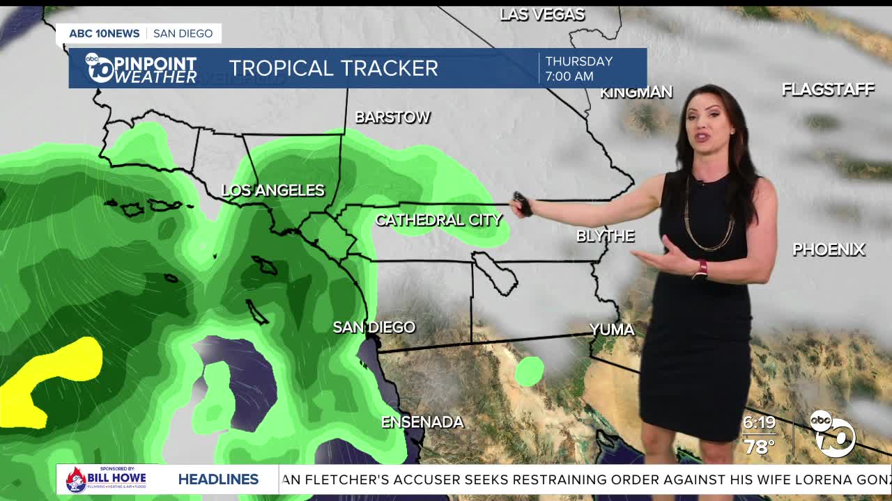
While it won't be as hot for the second half of the week, it will be more humid and will feel quite tropical across the county as remnant moisture from Tropical Cyclone Mario spreads into Southern California, bringing a chance of showers and thunderstorms anywhere in the county. Tomorrow afternoon a few isolated storms may develop with activity picking up late Wednesday night into Thursday.
Peak storm timing will be overnight Wednesday into Thursday with showers tapering off Thursday night. Isolated showers and thunderstorms will likely continue into Friday in the mountains and deserts, with a slight chance for the coast and valleys. A slight chance of storms may linger in the mountains and deserts Saturday with moisture tapering off Sunday.
Any storms that form may produce brief heavy rain, small hail, lightning, and the potential for urban flooding and localized flash flooding, especially in the mountains and deserts. There is a marginal threat of excessive rainfall for the mountains and deserts on Thursday.
Preliminary forecast totals will range anywhere from 0.15 to 1", locally up to 2" with the highest totals in the mountains.
The track of the storm will determine how much rain we get and which areas see the most rain, so be sure to stay with the Pinpoint Weather Team for updates on the timing and forecast totals of the incoming rain.
It will remain muggy through Saturday with more comfortable humidity levels by Monday and temperatures trending near average.
Fall is right around the corner! The Autumnal Equinox happens at 11:19am on Monday, September 22nd.
Wednesday's Highs:
Coast: 74-85°
Inland: 85-91°
Mountains: 77-89°
Deserts: 98-100°
Follow ABC 10News Meteorologist Megan Parry on Facebook at Megan Parry 10News, Instagram @mis_meg_wx and Twitter @10NewsParry.
