

We’ve made it to the weekend everyone!
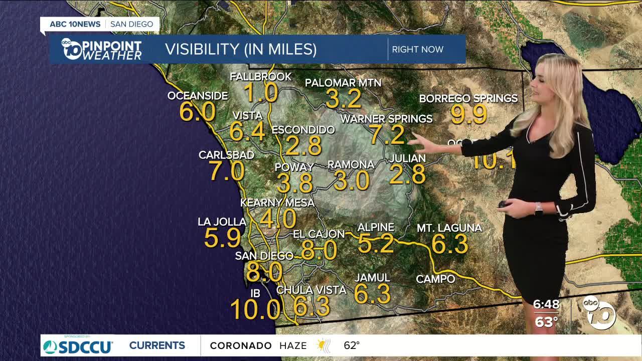
This morning, coastal and inland valleys might be noticing a little bit more fog than usual.
An atomospheric river is bringing lots of wet weather to the PNW, and despite a lack of rain chances in our forecast, we are still feeling some impacts through our marine layer.
It deepened Friday evening and is leaving us with patchy and dense fog today.
We will see it deepen even more into Sunday morning, so keep that in mind if you have to hit the roadways or the skies early tomorrow!
Temperatures on Saturday along our coastline will be in the upper 60s and low 70s.
Inland communities will reach highs in the upper 70s and low 80s.
Our mountains and deserts could see some westerly winds this afternoon, reaching 20 to 35mph.
Highs in the mountains will be in the upper 60s and low 70s, while our deserts will be in the low 90s.
We will be getting a warm-up next week and reaching temperatures above normal for this time of year.
By the time we hit Halloween, we will continue to see warm conditions so trick-or-treaters should have a pleasant candy-collecting forecast!
You can expect highs in the 70s and 80s for most of the county for the holiday.
Saturday's Highs:
Coast: 68-72°
Inland: 77-82°
Mountains: 72-80°
Deserts: 90-93°
Follow ABC 10News Weather Anchor Ava Kershner on Instagram, Facebook, and X.
