

The marine layer will return later tonight, spreading inland by Tuesday morning with patchy fog possible for the commute. Most of the county will be able to see the Super Moon tonight, though coastal areas will have the best chance early this evening before the clouds roll in.
Morning clouds will give way to sunny skies by mid to late morning, and temperatures near average by the afternoon. Similar conditions are expected on Wednesday.
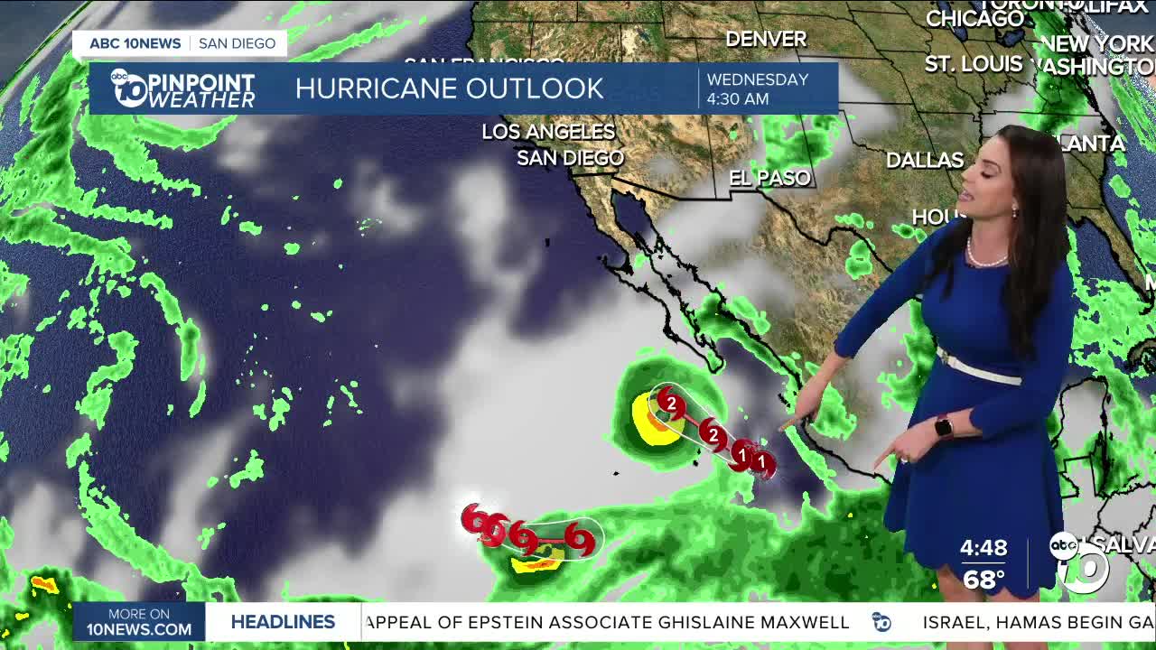
The end of the week becomes a little more interesting as moisture from Hurricane Priscilla, strengthening south of Cabo San Lucas, is pulled into Southern California with the help of a trough of low pressure that dives down from the Gulf of Alaska. This will bring a chance of showers as early as Thursday, with a better chance on Friday, along with possible thunderstorms. A slight chance of showers and thunderstorms may linger into Saturday.
There remains quite a bit of uncertainty on timing and totals as the track of the hurricane will determine how much rain we get and the likelihood of thunderstorms. Either way the mountains and deserts will likely see the brunt of the storm with the highest totals and best chance of thunderstorms. Stay with the Pinpoint Weather Team as we track this tropical moisture.
Temperatures will remain near average through Friday, then cool off this weekend with less humid conditions by Sunday. Below average temperatures are expected for most of the county Saturday through early next week.
Tuesday's Highs:
Coast: 70-76°
Inland: 75-82°
Mountains: 72-85°
Deserts: 92-96°
Follow ABC 10News Meteorologist Megan Parry on Facebook at Megan Parry 10News, Instagram @mis_meg_wx and Twitter @10NewsParry.
