

The warm weather from the weekend continued Monday with temperatures in the 70s and 80s for most of the county, and 90s for the hotter inland spots and deserts.
The marine layer returns tonight with patchy fog possible by the Tuesday morning commute. It will be slightly cooler tomorrow, though temperatures will still trend near to 6 degrees above normal, still mostly in the 70s and 80s.
High clouds stream across the county by the afternoon as a storm that has been stalled offshore starts to approach Southern California. This system will bring a 10 to 15 degree drop in temperatures away from the coast from Tuesday to Wednesday and a chance of patchy marine layer drizzle overnight Tuesday into Wednesday morning.
Warmer Thursday and Friday before another cool-down this weekend as a storm passes by to the north bringing a slight chance of showers late Saturday into Sunday. There remains uncertainty on if we even get rain, as the storm will weaken as it moves south through California.
This weekend you can expect mid-60s to mid-70s at the coast, mid-70s to low-80s inland, 60s in the mountains and mid-80s to low-90s in the desert.
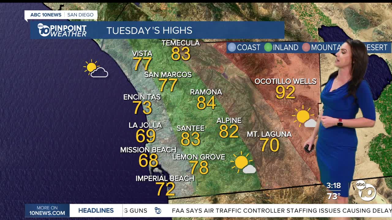
Tuesday's Highs:
Coast: 68-77°
Inland: 77-84°
Mountains: 70-85°
Deserts: 90-93°
Follow ABC 10News Meteorologist Megan Parry on Facebook at Megan Parry 10News, Instagram @mis_meg_wx and Twitter @10NewsParry.
