



Weather Headlines:
- Beach Hazards Statement until 2pm Thursday for elevated surf and tides
- Warmer second half of the week with 80s and 90s for the coast and valleys
- Heat Advisory for the coast Thursday through Saturday
- Santa Ana winds through Sunday, peaking Thursday night into Friday, as a moderate, to locally strong event.
- High Wind Warning for the inland and mountains Thursday through Saturday.
It will be another chilly morning Thursday, though not as cold as Wednesday morning, with mostly 50s for the coast, inland and deserts and 40s and 30s in the mountains.
Weak Santa Ana winds developed Wednesday and will become stronger by Thursday night into Friday, then taper off but remain offshore through the weekend.
A High Wind Warning will be in effect for the inland and mountain communities. For inland areas, it is in effect from 8pm Saturday until 8pm Saturday for northeast and easterly sustained winds of 15 to 30mph and gusts of 35 to 55mph and locally higher. While in the mountains, it begins earlier at 6am Thursday and lasts longer until midnight Saturday for stronger winds of 25 to 35mph and gusts of 50 to 65mph and isolated higher.
Humidity levels will drop between 10 and 25%, and while recent rain will help mitigate the fire danger, we will be near critical fire conditions and precautions should be taken.
These winds coupled with building high pressure, will warm temperatures 5 to 15, and locally 20 degrees above normal for the coast and valleys. Friday will be the warmest day, when we'll see 90s for most coast and valleys. A Heat Advisory will be in effect for the coast from 10am Thursday until 8pm Saturday for highs in the upper-80s to mid-90s.
The mountains and deserts will experience temperatures near to below average into the weekend.
A Beach Hazards Statement is in effect until 2pm Thursday for waves of 3 to 6 feet, strong rip currents, and with high tides between 6.5 to 7 feet, minor coastal flooding is still a concern.
Watching the track of Hurricane Simon, there is a slight chance that moisture could move out of ahead of the storm and bring a few showers to our mountains and deserts this weekend.
A cold Pacific storm will bring another chance of showers next week, while timing and impact remain uncertain. Some models show lighter rain moving in as early as Tuesday night, while another shows heavier rain but moving in later, Thursday and Friday.
Stay with the Pinpoint Weather Team as we track the strong winds this week and the chance of rain next week.
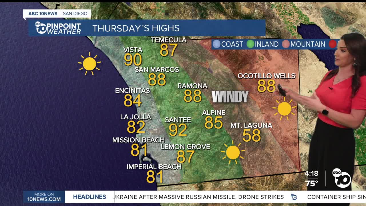
Thursday's Highs:
Coast: 80-90°
Inland: 87-93°
Mountains: 58-78°
Deserts: 86-89°
Follow ABC 10News Chief Meteorologist Megan Parry on Facebook at Megan Parry 10News, Instagram @mis_meg_wx and Twitter @10NewsParry.
