



Weather Headlines:
- The worst of the storm is over, but the threat of coastal flooding, gusty winds and periods of rain continues.
- A Flood Watch remains in effect until 8pm, though it may be canceled early.
- Coastal Flood Warning in effect until 3pm, then it will get downgraded to a Coastal Flood Advisory that lasts until 2pm Tuesday.
- Beach Hazards Statement in effect until 10pm Sunday
- Wind Advisory until 5am Monday for the mountains and deserts.
- A second storm from the Pacific will continue scattered showers Monday into Tuesday morning, but impacts will be minimal.
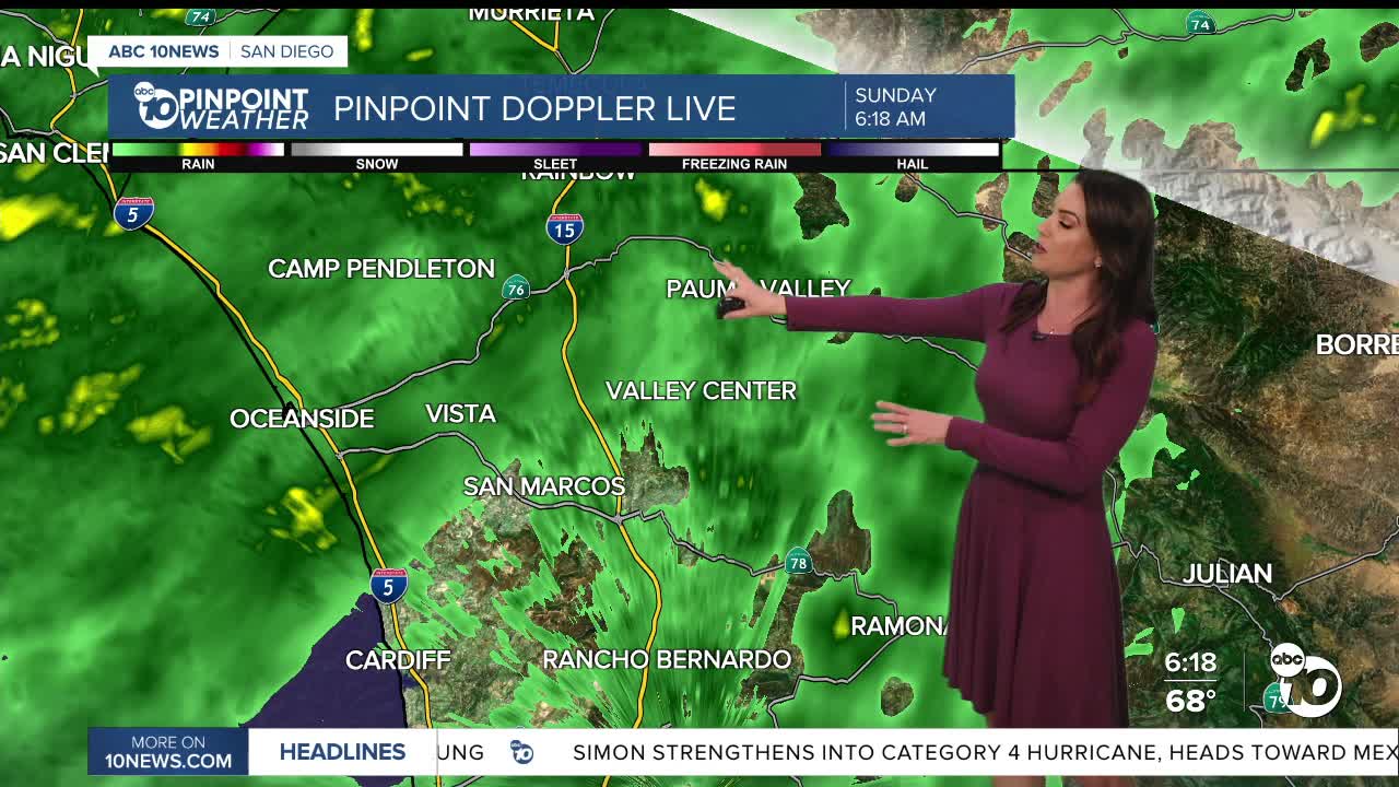
The Remnants of Rachel are moving out, but lingering showers will continue through the morning, tapering off into the afternoon before a colder Pacific storm brings another round of scattered light to moderate showers into Monday.
The biggest impacts from Rachel that will linger today are at the coast. Elevated surf and high tides will bring a significant threat of coastal flooding and beach erosion. A Coastal Flood Warning is in effect until 3pm Sunday, then it will be downgraded to a Coastal Flood Advisory until 2pm Tuesday for minor coastal flooding. A Beach Hazards Statement is in effect until 11pm Sunday for waves of 5 to 9 feet and dangerous rip currents.
While the worst of the rain is over, showers will continue today, though becoming more isolated by the afternoon. A Flood Watch remains in effect for the entire county until 10pm, though it may be canceled early by the National Weather Service. There is also a Flood Advisory for the San Diego River, which may reach action stage by noon which could lead to flooding around the river.
While the worst of the wind is over, it will remain breezy to gusty into Monday due to that Pacific storm. A Wind Advisory is in effect in the mountains and deserts until 5am Monday for southwesterly winds of 20 to 30mph, gusts of 35 to 45mph and isolated gusts to 60mph.
While Tropical Storm Rachel brought widespread rain totals over 1", even in the deserts, over 2" in may spots and even locally over 4" in the mountains, the colder Pacific storm will bring much lighter totals. Forecast totals for Monday into early Tuesday morning will average between a few hundredths of an inch to a quarter of an inch.
Monday is going to be the coldest day we have seen in a while! Temperatures will plummet 5 to 20 degrees below average and locally up to 25 degrees below average in the mountains! That means we'll see highs in the 60s for most coast and valleys, 40s and low-50s in the mountains and 70s in the deserts.
Sunshine returns by Tuesday afternoon and a warm-up with follow the rest of the week. Santa Ana winds are expected by the end of next week into the weekend bumping temperatures back into the 80s at the cosat and 90s inland. Luckily, this weekend's rain will help mitigate the fire danger.
Sunday's Highs:
Coast: 68-71°
Inland: 66-72°
Mountains: 55-63°
Deserts: 75-78°
Follow ABC 10News Chief Meteorologist Megan Parry on Facebook at Megan Parry 10News, Instagram @mis_meg_wx and Twitter @10NewsParry.
