

Patchy low clouds and fog overnight into Thursday morning, quickly clearing to sunny skies. It will be a touch warmer tomorrow, with temperatures trending right on par for average for early October.
Starting Friday, the marine layer will spread farther inland and will continue to deepen each day into early next week as a pair of storms pass well to the north of San Diego. Rain doesn't look likely locally, but we may be able to squeeze out some patchy marine layer drizzle.
This weekend into early next week, we can expect highs in the 70s along the coast and valleys, 60s in the mountains, and 80s to low-90s in the deserts.
The 2024-2025 water year ended yesterday, and it will go down as a deficit year. Records are kept at the San Diego International Airport, and we finished 4.72" shy of our annual average of 9.79", receiving only 5.07" of rain. San Diego is mostly in level 2 drought, or "Severe", with the northern mountains and deserts in a level 3 drought, or "Extreme."
Click here to see California Drought conditions.
I'm tracking a tropical system potentially forming early next week, south of Baja, bringing us a chance of rain by the end of next week. This would be the first rain of the new water year, and would be beneficial ahead of the Santa Ana season.
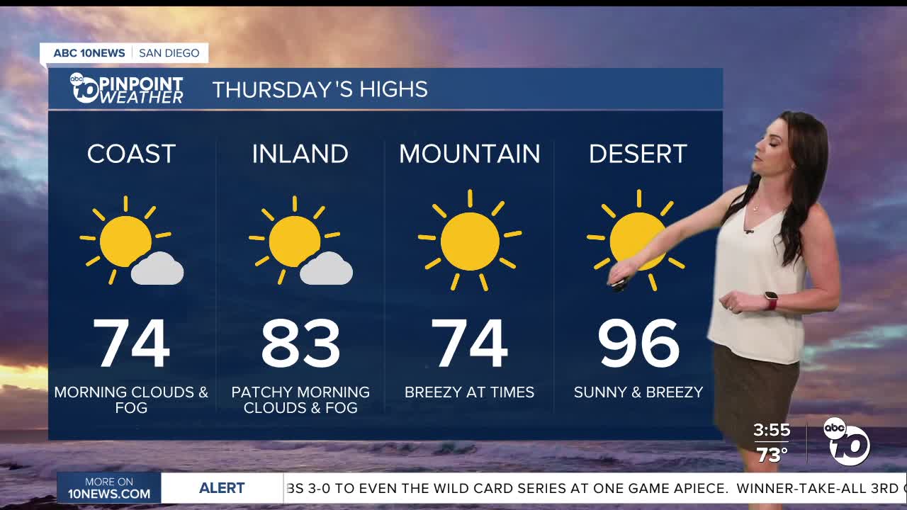
Thursday's Highs:
Coast: 71-77°
Inland: 78-85°
Mountains: 72-84°
Deserts: 94-97°
Follow ABC 10News Meteorologist Megan Parry on Facebook at Megan Parry 10News, Instagram @mis_meg_wx and Twitter @10NewsParry.
