

The marine layer will continue to spread inland tonight with patchy dense fog possible into Saturday morning. Uneven clearing along the coast with stubborn clouds for some areas into the afternoon. Patchy dense fog will be possible for the coast and valleys each night and morning through at least Monday.
A Beach Hazards Statement remains in effect until 2am Saturday for waves of 4 to 8 feet, highest south of Del Mar, and King Tides. Minor coastal overflow isn't likely, but is possible. High tide Saturday is at 10:06am.
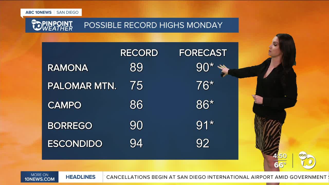
High pressure will build over the weekend as winds will turn weakly offshore, leading to drier conditions and warmer weather. This weekend we'll see 70s for the coast and mountains, with 80s and 90s for the inland valleys and deserts. Temperatures on Sunday will be up to 15 degrees warmer than normal, and up to 20 degrees above average on Monday, which will be the warmest day, when we'll see 80s all the way to the coast and 90s inland. A few record highs will be within reach both days.
Click here to see local records and averages.
By mid to late next week, our weather pattern shifts with the chance of widespread rain moving into the county. There remains quite a bit of uncertainty on timing and totals but given our Moderate and Severe drought conditions, any rainfall is welcome! At this point rain is looking possible as early as Thursday night but may hold off until the weekend. Stay with the Pinpoint Weather Team for updates.
Saturday's Highs:
Coast: 69-75°
Inland: 74-84°
Mountains: 67-84°
Deserts: 88-91°
Follow ABC 10News Meteorologist Megan Parry on Facebook at Megan Parry 10News, Instagram @mis_meg_wx and Twitter @10NewsParry.
