

After the coolest day of the week, Wednesday, temperatures will be going up into the weekend. The marine layer will become much shallower with only patchy low clouds and fog the next several nights and mornings.
Still breezy in the mountains and deserts tomorrow, though westerly winds will mostly be 15 to 25mph, occasionally to 30mph.
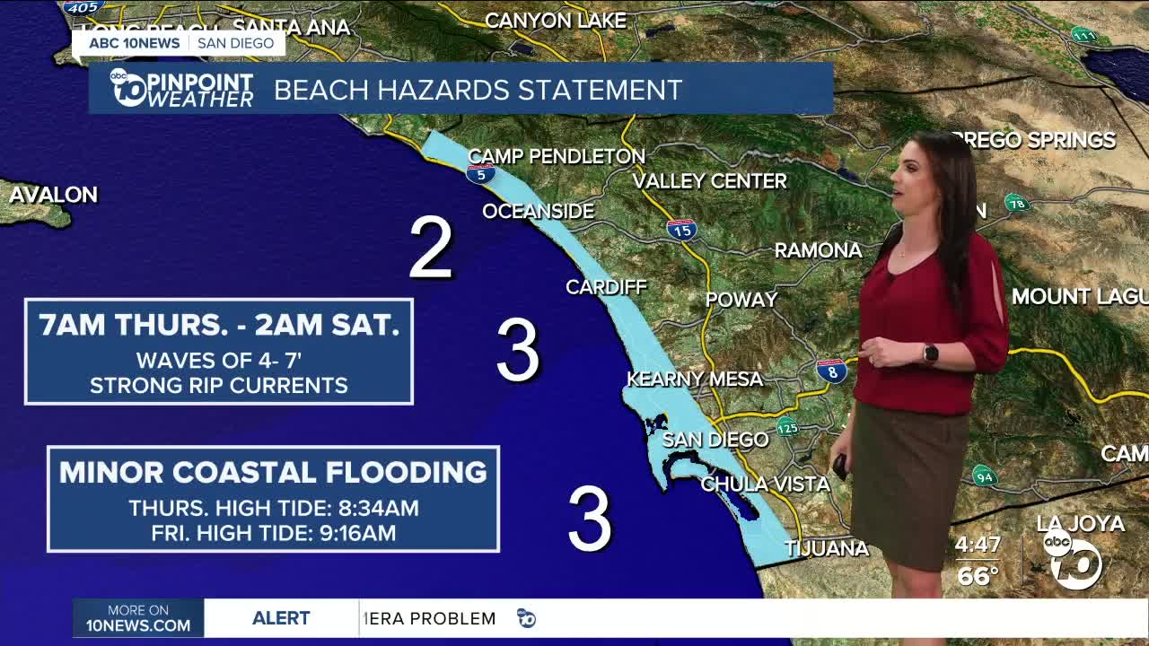
King Tides will impact the coast on Thursday and Friday, along with elevated surf, which may lead to minor coastal flooding. A Beach Hazards Statement will be in effect from 7am Thursday until 2am Saturday. King Tides peak on Thursday, when the greatest threat of minor flooding is expected. High Tide Thursday is at 8:34am and Friday at 9:16am.
Winds turn weakly offshore this weekend, leading to drier conditions and warmer weather. This weekend we'll see 70s for the coast and mountains with 80s inland and deserts. Sunday and Monday will be the warmest day with highs 5 to 15 degrees above average.
By mid to late next week, our weather pattern shifts with the chance of widespread rain moving into the county. There remains quite a bit of uncertainty but given our Moderate and Severe drought conditions, any rainfall is welcome!
Thursday's Highs:
Coast: 68-73°
Inland: 71-76°
Mountains: 63-75°
Deserts: 86-88°
Follow ABC 10News Meteorologist Megan Parry on Facebook at Megan Parry 10News, Instagram @mis_meg_wx and Twitter @10NewsParry.
