

The marine layer will build earlier tonight and spread farther inland by tomorrow morning, enhanced from a storm passing to the north. Anything from sprinkles, mist or patchy drizzle will be possible into Wednesday morning along with possible fog. Little to no accumulation is expected.
That storm will also pick up the winds in the mountains and deserts on Wednesday and Thursday with westerly winds of 20 to 30mph.
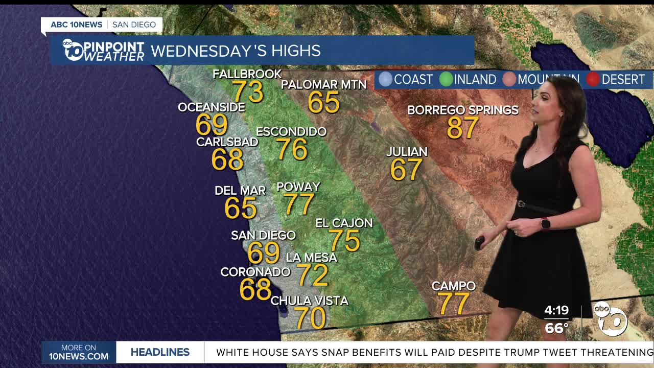
Temperatures will trend near to 5 degrees below average for the coast and valleys through Thursday and up to 5 degrees above normal in the mountains and deserts. Through Thursday you can expect 60s and 70s for most of the county.
Winds turn weakly offshore this weekend, leading to more sunshine, drier conditions, and warmer weather. This weekend we'll see 70s for the coast and mountains with 80s inland and deserts.
King Tides will impact the coast on Thursday and Friday, along with elevated surf, which may lead to minor coastal flooding. King Tides peak on Thursday when the greatest threat of minor flooding will occur. Surf of 4 to 7 feet is expected, locally higher on west-facing beaches with a high rip current risk. King tides will coincide with the elevated surf to create minor tidal overflow in parking lots and along sidewalks both Thursday and Friday.
High Tides for La Jolla Scripps Pier:
Wednesday 11/5: 6.8 ft at 8:06 AM
Thursday 11/6: 6.9 ft at 8:42 AM
Friday 11/7: 6.8 ft at 9:06 AM
Looking ahead to next week there is a chance the storm door will be opening in Southern California. There are potentially three storms that could bring rain to the county starting as early as Wednesday next week. There remains quite a bit of uncertainty but given our Moderate and Severe drought conditions, any rainfall is welcome!
Wednesday's Highs:
Coast: 66-72°
Inland: 72-77°
Mountains: 63-77°
Deserts: 87-89°
Follow ABC 10News Meteorologist Megan Parry on Facebook at Megan Parry 10News, Instagram @mis_meg_wx and Twitter @10NewsParry.
