

Most of the county got a break from the rain today with just a few stray showers, mostly in the mountains. Storm three of the week brings another round of widespread rain, gusty winds and a slight chance of thunderstorms starting tomorrow afternoon.
Click here to see rainfall totals where you live.
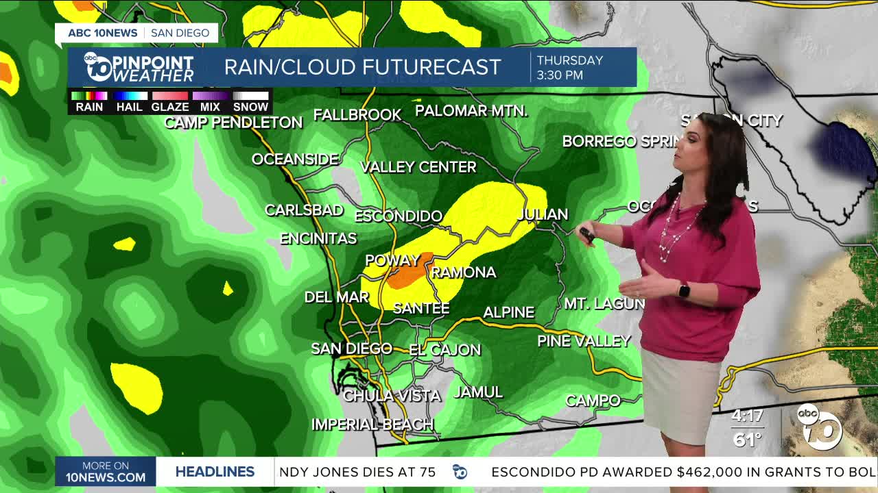
While there is a slight chance of a stray light shower Thursday morning, the brunt of the moisture arrives in the afternoon. Rain will pick up mostly after 2/3pm along the coast and spread inland with the most widespread rain between 3/4pm and 9/10pm. With hours of steady rain localized flooding and ponding on the roadways will be a concern. The evening commute is likely going to be mess, so if it's possible to head home early, you may want to.
This storm, just like the last two, is going to get separated from the jet stream which makes it a bit trickier to forecast. The storm will dive south of San Diego into Friday and depending on how far away it tracks will determine how much rain we see on Friday. You can at least expected scattered showers, light to heavy, and a slight chance of thunderstorms, best chance of impactful rain on Friday will be in the mountains and deserts.
Rain tapers off during the day Saturday, but if the storm stalls we may see rain last a little longer.
Rainfall totals will average between .75 to 1.50" for the coast and valleys, 1 to 2.50" in the mountains and .25 to 1" in the desert.
Gusty winds will accompany this storm with gusts of 20 to 30mph for the coast and valleys and up to 40mph in the mountains and deserts.
Sunshine returns on Sunday with warming temperatures into Thanksgiving next week, and we should get a break in the rain through the holiday.
Thursday's Highs:
Coast: 60-63°
Inland: 58-65°
Mountains: 42-56°
Deserts: 67-69°
Follow ABC 10News Meteorologist Megan Parry on Facebook at Megan Parry 10News, Instagram @mis_meg_wx and Twitter @10NewsParry.
