

Warmer today with 70s and 80s for most of the county and 100s in the deserts. While clouds cleared to sunshine, the marine layer is already returning along the coast. Clouds will spread inland overnight into Saturday morning with patchy fog for the coast and valleys.
Clouds will give way to sunny skies by mid to late morning with stubborn clouds possible at some beaches.
It will be breezy in the mountains and deserts with westerly gusts of 20 to 30mph through Saturday.
Temperatures continue to warm into the weekend, with Monday expected to be the warmest day, though above-normal temperatures will likely persist through most of next week.
Temperatures will top out 5 to nearly 20 degrees above average across the county by Monday as high pressure builds over the west. We may even set some record highs on Monday in the mountains and deserts.
This Mother's Day weekend, you can expect 70s for the coast, 80s inland, 70s and 80s in the mountains, and 100s in the deserts.
An Extreme Heat Warning will be in effect for the deserts from 10am Sunday until 8pm Monday for highs between 103 and 109 degrees.
The marine layer will be present each night and morning, with patchy fog along the coast and in the valleys. Most areas will clear quickly to sunny skies, but low clouds, aka May Gray, may linger at some beaches into the afternoon. When high pressure brings warm weather inland, it creates a greater temperature inversion from the cool ocean water, leading to a persistent cloud bank stuck at the beach.
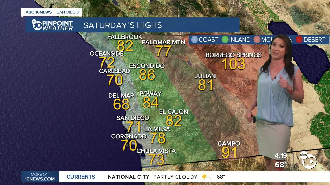
Saturday's Highs:
Coast: 67-75°
Inland: 73-86°
Mountains: 75-91°
Deserts: 102-106°
Follow ABC 10News Meteorologist Megan Parry on Facebook at Megan Parry 10News, Instagram @mis_meg_wx and Twitter @10NewsParry.
