

The marine layer will be more stubborn this weekend as a storm passes through the Pacific Northwest. This will bring a deepening marine layer locally, slower-to-limited clearing, patchy drizzle, and gusty winds in the mountains and deserts.
A Wind Advisory will be in effect for the mountains and deserts from 2pm Saturday until 11pm Sunday for westerly winds of 25 to 35mph and gusts of 40 to 60mph. You may want to secure loose outdoor items and the wind may blow dust and dirt around in the deserts.
The best chance of any marine layer drizzle will be in the overnight and morning hours Saturday night through Monday morning.
Starting Saturday, clouds may linger along the coast all day, with slower clearing inland, while Sunday will likely be a May Gray day for most of the coast and valleys, with little sunshine.
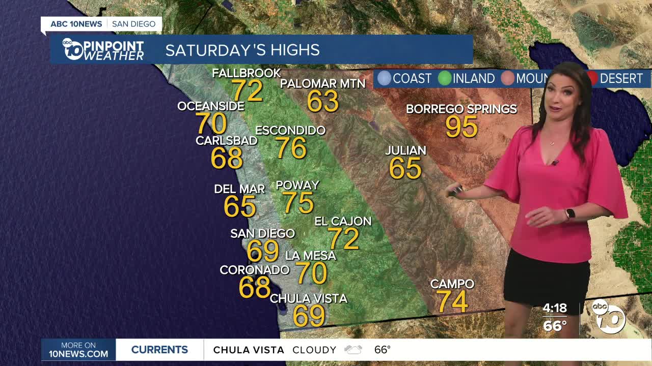
This weekend we'll see 60s for the coast and mountains, 70s Saturday for the valleys and 60s Sunday with the deserts in the low to mid 90s.
Temperatures rebound on Monday with faster clearing of the marine layer and continued warming through midweek, when we'll see 70s for the coast and mountains, possibly some 80s inland, while 90s continue in the deserts.
Warm weather sticks all week as weak high pressure develops over the west.
Saturday's Highs:
Coast: 65-70°
Inland: 68-76°
Mountains: 62-74°
Deserts: 94-97°
Follow ABC 10News Meteorologist Megan Parry on Facebook at Megan Parry 10News, Instagram @mis_meg_wx and Twitter @10NewsParry.
