

It was significantly cooler today! From 80s and 90s for most of the county Sunday, into the 60s and 70s Monday! It will continue to cool this week, with Wednesday and Thursday the coolest days of as a trough of low pressure pushes that warm high pressure ridge away to the east.
A storm passing to the north of us will bring a slight chance of showers late Tuesday night into early Wednesday morning, mostly before the morning commute. Though both Tuesday and Wednesday morning we may get marine layer drizzle.
Accumulations, if any, will be light between a trace to .10" from the coast to the mountains, with no rain making it to the deserts.
Winds will build late Tuesday ahead of the storm with a Wind Advisory for the mountains and deserts from 8pm Tuesday until 11pm Wednesday. Expect westerly winds of 20 to 30mph and peak gusts near 50mph. The coast and valleys will be breezy, with westerly winds of 15 to 30 mph on Wednesday.
Wednesday and Thursday will be the coolest days with mid-60s to low-70s for the coast and valleys, 50s in the mountains and 80s in the deserts.
Much warmer by Easter weekend as high pressure starts to build and we may see mild Santa Ana winds. Easter will bring mostly sunny to partly cloudy skies and highs in the 70s at the coast, 80s inland, 60s and 70s in the mountains, and 90s in the deserts.
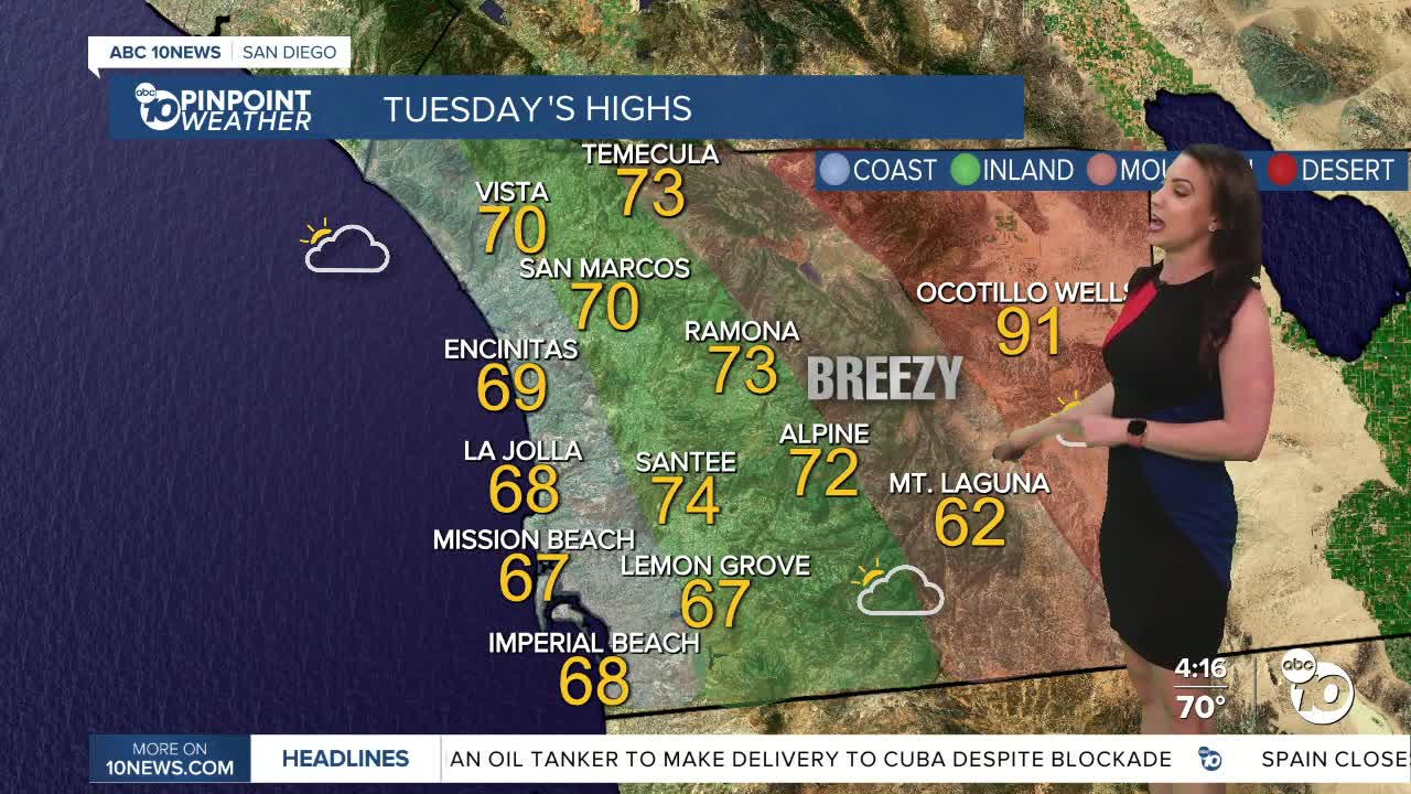
Tuesday's Highs:
Coast: 67-70°
Inland: 67-75°
Mountains: 62-75°
Deserts: 89-92°
Follow ABC 10News Meteorologist Megan Parry on Facebook at Megan Parry 10News, Instagram @mis_meg_wx and Twitter @10NewsParry.
