


Another picture-perfect day in America's Finest City! The marine layer returns overnight, with patchy fog for the morning commute along the coast and in the valleys. Clouds will clear to sunny skies by mid to late morning.
Patchy dense fog is possible Wednesday and Thursday mornings, dropping visibility down to a quarter of a mile or less.
Temperatures will top out near to 10 degrees above average Wednesday; 5 to 10 degrees cooler in the mountains and deserts starting Thursday, which will be closer to early March normals.
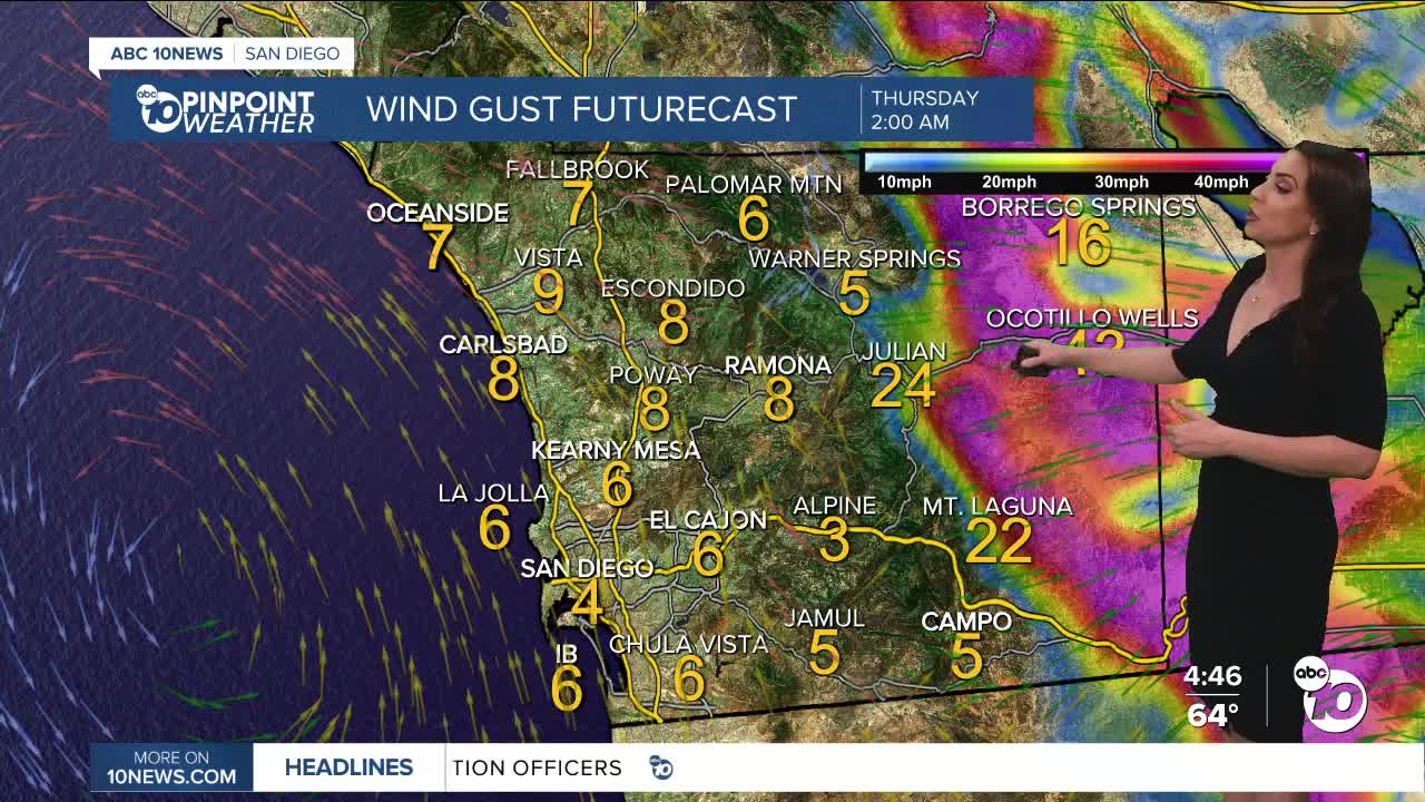
The wind will build in the mountains and deserts late Wednesday with a Wind Advisory in effect from 10pm Wednesday to 10am Thursday for westerly winds of 25 to 35mph, gusts of 45 to 55mph and isolated gusts to 65mph.
A storm diving south from the Gulf of Alaska is responsible for all of our weather this week. As it approaches, it is acting to enhance the marine layer and bring the gusty winds on Wednesday and Thursday. Then it dives south, setting up to bring us Santa Ana winds Friday through Sunday, peaking Saturday.
This will be a moderate to potentially strong Santa Ana wind event, but it will depend on where the storm ends up.
That storm then moves over the Pacific and potentially brings us a chance of rain late Sunday through Tuesday, with the best chance on Monday. The track will determine whether we get any rain, so stay with the Pinpoint Weather Team, San Diego's Most Accurate Forecast, for updates.
Wednesday's Highs:
Coast: 65-70°
Inland: 68-75°
Mountains: 63-74°
Deserts: 85-88°
Follow ABC 10News Meteorologist Megan Parry on Facebook at Megan Parry 10News, Instagram @mis_meg_wx and Twitter @10NewsParry.
