

Thursday is the 12th consecutive day of record heat! Daily record highs were set in Borrego Springs (98°), Campo (91°), Lake Cuyamaca (79°) and Palomar Mountain (76°).
I'm forecasting record highs in Campo and Palomar Mountain on Friday, but only a degree or two shy in Escondido, Ramona and Borrego Springs. In fact, daily record high temperatures are expected through the weekend, mostly in the mountains and deserts and possibly some inland areas.
Temperatures will trend 10 to 20 degrees above normal for most of the county through the weekend, with Friday and Saturday the warmest days of the week.
High pressure once again is the reason for the heat this week, though it's not as strong as last week when we set all-time March temperatures.
Low clouds and patchy fog return to the coast and valleys tonight into Friday morning, clearing out by mid to late morning. High clouds will build late Friday with more clouds through the day Saturday.
Much cooler next week with temperatures plummeting 10 to 25 degrees from the worst of the heat this week by Wednesday! That will take temperatures near to slightly below average.
Wednesday will be the coolest day of the week next week with highs in the 60s for most of the coast and valleys, 50s in the mountains, and 80s in the deserts.
A storm passing to the north will bring the cool-down next week and a slight chance of showers, potentially as early as Tuesday, best chance Wednesday, and may linger into Thursday. It doesn't look like a lot of rain with preliminary forecasts less than .25" from the coast to the mountains.
Stay with the Pinpoint Weather Team, San Diego's Most Accurate Forecast, for updates.
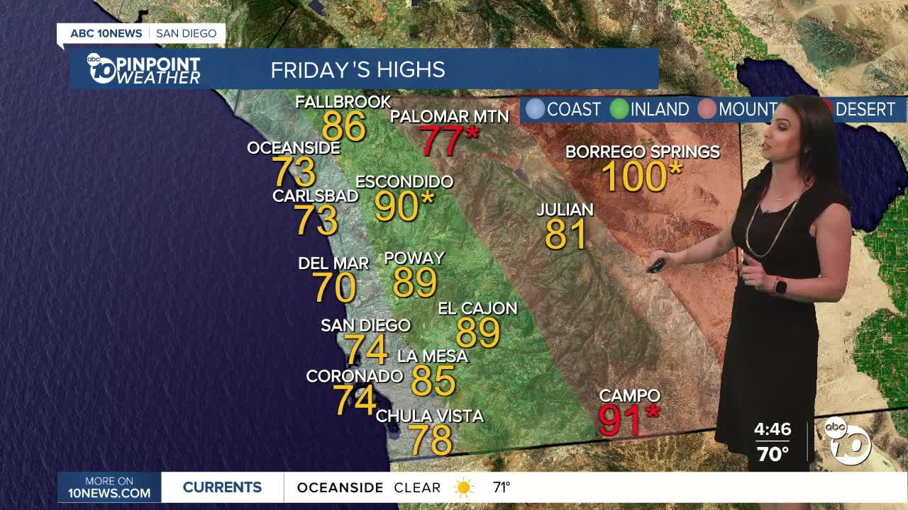
Friday's Highs:
Coast: 70-78°
Inland: 80-91°
Mountains: 77-91°
Deserts: 99-103°
Follow ABC 10News Meteorologist Megan Parry on Facebook at Megan Parry 10News, Instagram @mis_meg_wx and Twitter @10NewsParry.
