

Temperatures plummeted 10 to nearly 20 degrees today from the record heat on Sunday, this after days of record heat.
Despite the drop in temperatures, highs still topped out mostly 5 to 10 degrees above average away from the coast.
Gusty winds in the mountains and deserts on Monday will continue tonight, becoming lighter on Tuesday.
Patchy fog is possible by Tuesday morning, with fog likely more widespread on Wednesday morning, when dense fog will be a concern, dropping visibility down to a quarter of a mile or less.
Little change in temperatures through Wednesday, becoming cooler by Thursday as a storm passes by to the north of us.
That storm will enhance our marine layer and potentially bring patchy drizzle with gusty winds in the mountains and deserts.
Winds turn offshore with moderate to potentially strong Santa Ana winds Friday and Saturday; this will depend on where the storm ends up.
That same storm will split in two and dive south, separate from the jet stream, and bring a slight chance of rain late Sunday into Monday. The track will determine whether we get any rain, so stay with the Pinpoint Weather Team, San Diego's Most Accurate Forecast, for updates.
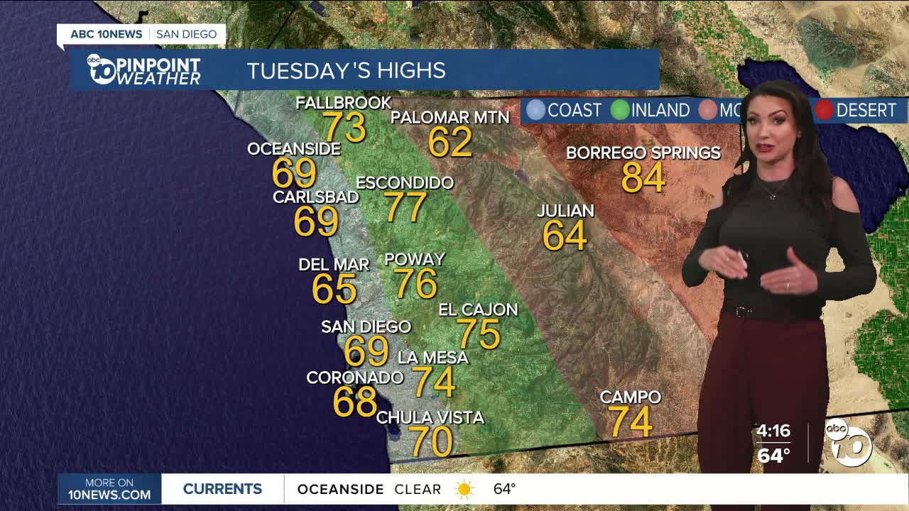
Tuesday's Highs:
Coast: 65-71°
Inland: 72-77°
Mountains: 61-74°
Deserts: 83-86°
Follow ABC 10News Meteorologist Megan Parry on Facebook at Megan Parry 10News, Instagram @mis_meg_wx and Twitter @10NewsParry.
