

It was warmer on Wednesday by 5 to 18 degrees away from the immediate coast, with the biggest temperature jump in the mountains. In fact, Palomar Mountain tied their daily record high of 72 degrees. Much hotter Thursday as temperatures soar 15 to 25 degrees above average across the county!

Several record highs are expected on Thursday.
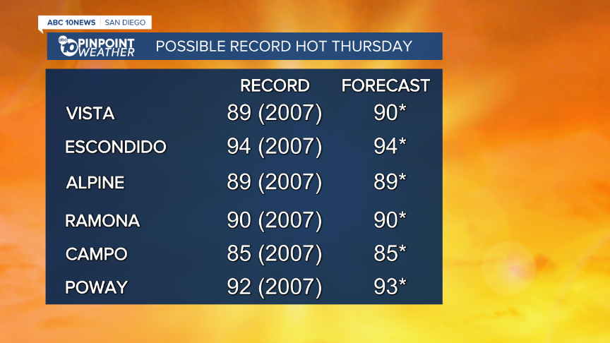
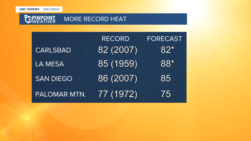
A Heat Advisory will be in effect from 10am Thursday until 8pm Friday for the coast and valleys. Expect mid-70s to mid-80s at the coast, and mid-80s to mid-90s inland.
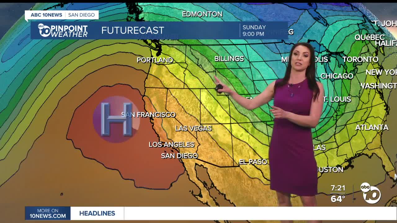
High pressure with weak Santa Ana winds will be responsible for the heat Thursday and Friday. The sea breeze returns over the weekend, and high pressure weakens, leading to a minor and brief drop in temperatures. Despite the drop, temperatures will remain 10 to 15 degrees above average. Expect low to mid-70s at the coast, low to mid-80s inland, low to mid-70s in the mountains and mid-90s in the deserts.
Warmer weather is expected next week as another round of high pressure builds over the west. In fact, the warmest days of the next two weeks will be next week in the mountains and deserts and we'll be close to some all-time record warm March temperatures this week and next. This is just two weeks after setting all-time record warm February temperatures in parts of the county.
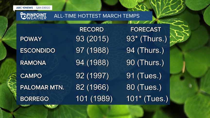
The warm weather is likely going to stick around well into March as the Climate Prediction Center is forecasting above normal temperatures through March 25.

Thursday's Highs:
Coast: 77-85°
Inland: 86-95°
Mountains: 72-85°
Deserts: 94-97°
Follow ABC 10News Meteorologist Megan Parry on Facebook at Megan Parry 10News, Instagram @mis_meg_wx and Twitter @10NewsParry.
