

Low clouds and patchy fog will be possible Wednesday morning with faster clearing to sunny skies and warmer temperatures as high pressure builds.
Temperatures warm 5 to 12 degrees from Tuesday to Wednesday with another 5 to 15 degree jump by Thursday. Thursday and Friday will be the hottest days of the week as highs soar 15 to 25 degrees above average!
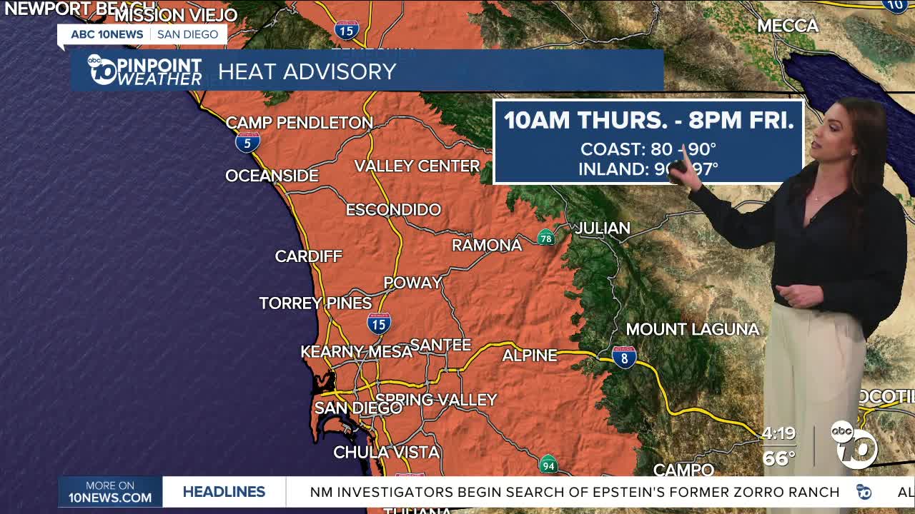
A Heat Advisory will be in effect from 10am Thursday until 8pm Friday, with temperatures in the 80s along the immediate coast and 90s about 5 to 10 miles inland, reaching into the foothills.
The mountains will be in the 70s and 80s and 90s in the deserts.
High pressure with weak Santa Ana winds will be responsible for the heat Thursday and Friday. The sea breeze returns over the weekend, and high pressure weakens, which will lead to a minor drop in temperatures. Despite the drop, temperatures will remain 10 to 15 degrees above average.
Warmer weather is expected next week as another round of high pressure builds over the west. Several record highs will likely fall later this week into next week.
Wednesday's Highs:
Coast: 67-73°
Inland: 75-82°
Mountains: 65-79°
Deserts: 85-88°
Follow ABC 10News Meteorologist Megan Parry on Facebook at Megan Parry 10News, Instagram @mis_meg_wx and Twitter @10NewsParry.
