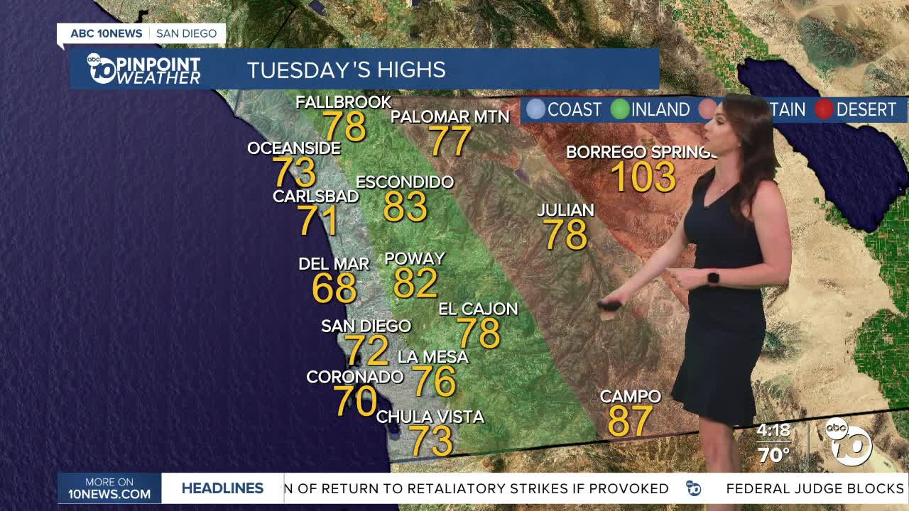


The marine layer will be shallower this week, so it won't extend as far inland. Morning clouds will quickly clear to sunny skies Tuesday, and it will be a touch warmer with temperatures trending near average across the county.
High pressure will build over the west, bringing a warm-up for the second half of the week with temperatures topping out 3 to 10 degrees above average. Friday through Sunday will be the warmest days this week, with mid-70s at the coast, mid- to upper-80s inland and in the mountains, and around 110 degrees in the deserts.
On top of the heat, humidity may also rise Friday through Sunday as our first surge of monsoon moisture could reach San Diego County. The deserts have the best chance for higher humidity, making those 110-degree temperatures feel even more uncomfortable. Clouds will likely build over the mountains each afternoon, but the potential for any rain is minimal.
A storm will move into the Northwest next week, pushing the humid air farther east. It also won't be as warm, with temperatures dropping back near average and the marine layer will spread farther inland.
Tuesday's Highs:
Coast: 68-74°
Inland: 75-83°
Mountains: 76-87°
Deserts: 102-105°
Follow ABC 10News Meteorologist Megan Parry on Facebook at Megan Parry 10News, Instagram @mis_meg_wx and Twitter @10NewsParry.
