

Clouds were stubborn for many coastal communities today and will be even more so on Saturday.
A trough of low pressure (a storm) will move into the Pacific Northwest this weekend, deepening the marine layer locally and bringing a cool-down. Saturday will see the slowest clearing with mostly cloudy to partly cloudy skies for most coast and valley areas all day. Even the mountains and deserts will see partly to mostly sunny skies, with plenty of high clouds in the mix.
This weekend into early next week temperatures will trend in the mid-60s to low-70s at the coast, mid to upper-70s inland, 70s in the mountains and low-100s in the deserts.
The storm track will remain active in the Northwest through midweek, continuing to influence our marine layer. Temperatures look to trend near average through at least mid-next week, with morning clouds clearing to sunny skies.
High pressure ramps up by the end of the week, leading to a warm-up taking temperatures back into the 80s away from the coast. This may be a long stretch of warm weather as high pressure builds over the west and sticks around.
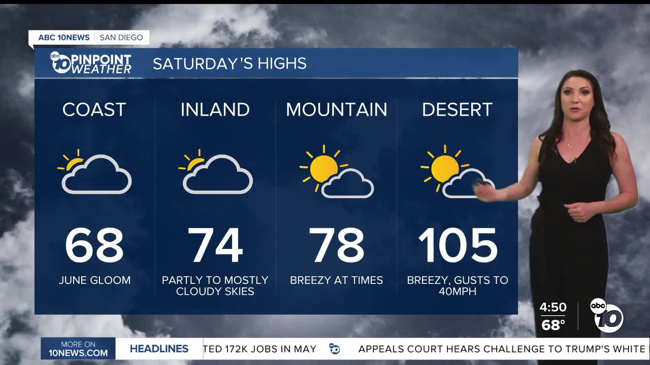
Saturday's Highs:
Coast: 66-70°
Inland: 68-78°
Mountains: 75-84°
Deserts: 103-106°
Follow ABC 10News Meteorologist Megan Parry on Facebook at Megan Parry 10News, Instagram @mis_meg_wx and Twitter @10NewsParry.
