

The marine layer will produce areas of fog for the morning commute on Friday, and it may be dense at times, so be sure to leave time for travel.
Clouds will be more stubborn along the coastline with uneven clearing. Some areas will be stuck in the clouds all day or will only see partial clearing before the clouds roll back. Inland areas will still be mostly clear by mid to late morning.
A trough of low pressure (a storm) will move into the Pacific Northwest this weekend, deepening the marine layer locally and bringing a cool-down. Saturday will see the slowest clearing with mostly cloudy to partly cloudy skies for most coast and valleys all day.
This weekend into next week temperatures will trend in the mid-60s to low-70s at the coast, mid-70s to a few low-80s inland, 70s in the mountains and low-100s in the deserts.
The storm track will remain active in the Northwest into next week, continuing to influence our marine layer. Temperatures look to trend near average through at least mid-next week, with morning clouds clearing to sunny skies.
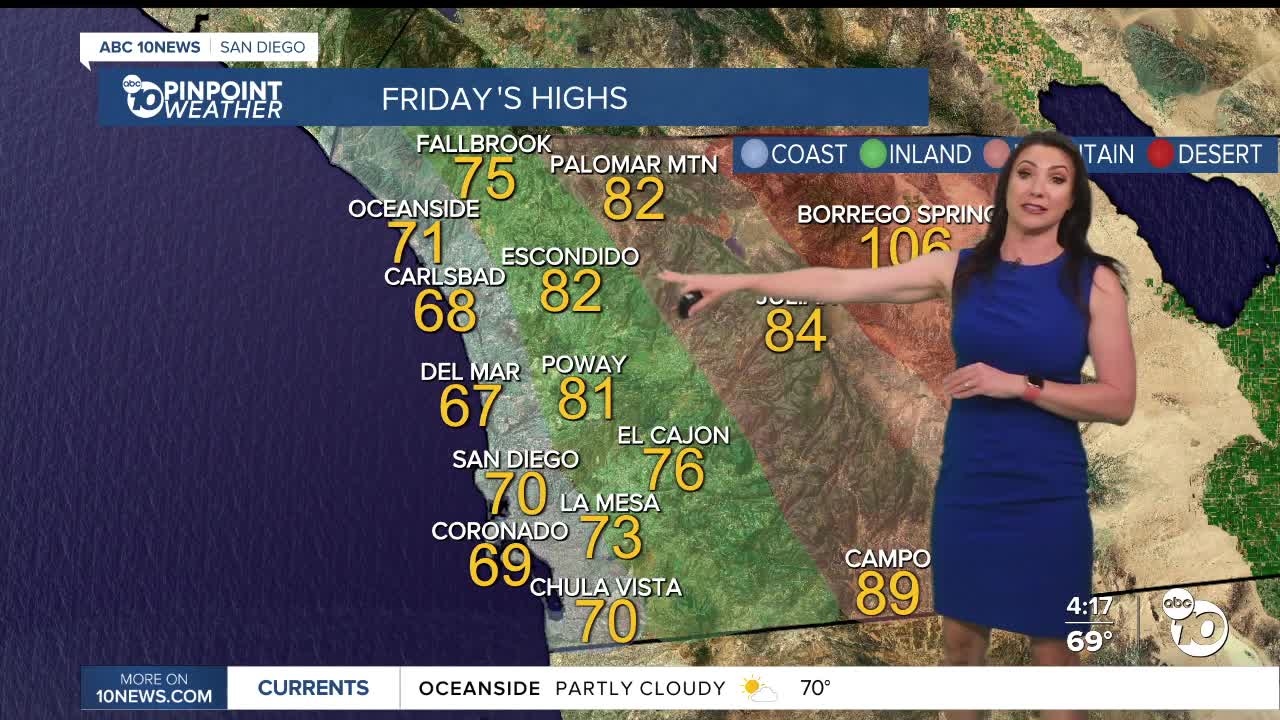
Friday's Highs:
Coast: 67-72°
Inland: 72-83°
Mountains: 81-89°
Deserts: 105-108°
Follow ABC 10News Meteorologist Megan Parry on Facebook at Megan Parry 10News, Instagram @mis_meg_wx and Twitter @10NewsParry.
