

While Tuesday will be the coolest day of the week, temperatures will remain below average through Friday. Wednesday temperatures will top out 5 to 15 degrees below average away from the coast, with gradual warming into the 4th of July weekend.
It will remain breezy to gusty in the afternoon and evenings, especially in the mountains and deserts, where you can expect westerly gusts of 20 to 40mph. Winds will taper off each day into the weekend.
High pressure, which is bringing extreme heat to so much of the eastern half of the country, will start to expand west this weekend and even more so next week. This will bring warmer weather locally, though extreme temperatures aren't expected for most of the county.
Temperatures will trend closer to normal this weekend, with low to mid-70s at the coast, low to mid-80s inland, upper-70s to low-80s in the mountains, and the deserts warming to 105 to 110 degrees.
Warmer weather will stick around into next week, and by next weekend we may get a surge of monsoon moisture, adding higher humidity and perhaps a chance of mountain storms.
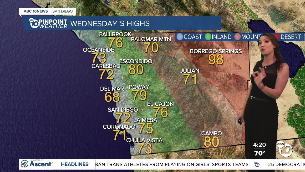
Wednesday's Highs:
Coast: 68-73°
Inland: 71-80°
Mountains: 70-80°
Deserts: 97-102°
Follow ABC 10News Meteorologist Megan Parry on Facebook at Megan Parry 10News, Instagram @mis_meg_wx and Twitter @10NewsParry.
