

The marine layer will be shallower on Thursday and Friday which means fog is more likely for the morning commutes and may be dense at times so be sure to leave time for travel.
Clouds will give way to sunny skies by mid to late morning for most areas but some beaches may see the June Gloom linger into the afternoon, especially on Friday.
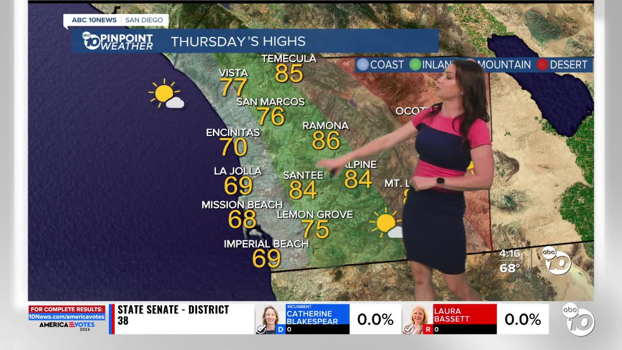
Thursday will be the warmest day of the week, with mostly 70s along the coast, mid-70s to mid-80s for inland and mountain communities, and around 106 to 109 in the deserts.
A trough of low pressure (a storm) will move into the Pacific Northwest this weekend, deepening the marine layer locally and bringing a cool-down.
This weekend, you can expect slower clearing of the marine layer for the coast and valleys, with temperatures dropping mostly into the 60s at the coast, 70s inland to the mountains while it will remain seasonably hot in the deserts in the low-100s.
The storm track will remain active in the Northwest into next week, continuing to influence our marine layer. Temperatures look to trend near average through at least mid-next week, with morning clouds clearing to sunny skies.
Thursday's Highs:
Coast: 67-75°
Inland: 75-86°
Mountains: 80-92°
Deserts: 106-109°
Follow ABC 10News Meteorologist Megan Parry on Facebook at Megan Parry 10News, Instagram @mis_meg_wx and Twitter @10NewsParry.
