

A weak disturbance will pass through Central California into Tuesday, enhancing our local marine layer and possibly bringing patchy drizzle overnight into Tuesday morning.
Tuesday will be the coolest day of the week with temperatures trending 3 to 17 degrees below average across the county.
It will remain breezy to gusty in the afternoon and evenings, especially in the mountains and deserts, where you can expect westerly gusts of 20 to 35mph.
High pressure, which is bringing extreme heat to so much of the eastern half of the country, will start to expand west this weekend and potentially even more so next week. This will bring warmer weather this 4th of July weekend.
Temperatures will be trending closer to normal this weekend with low to mid-70s at the coast, low to mid-80s inland, upper-70s to low-80s in the mountains, while the deserts will warm between 105 and 110 degrees.
Warmer weather will stick around into next week, and by mid-July we may get a surge of monsoon moisture, adding higher humidity and perhaps a chance of mountain rain.
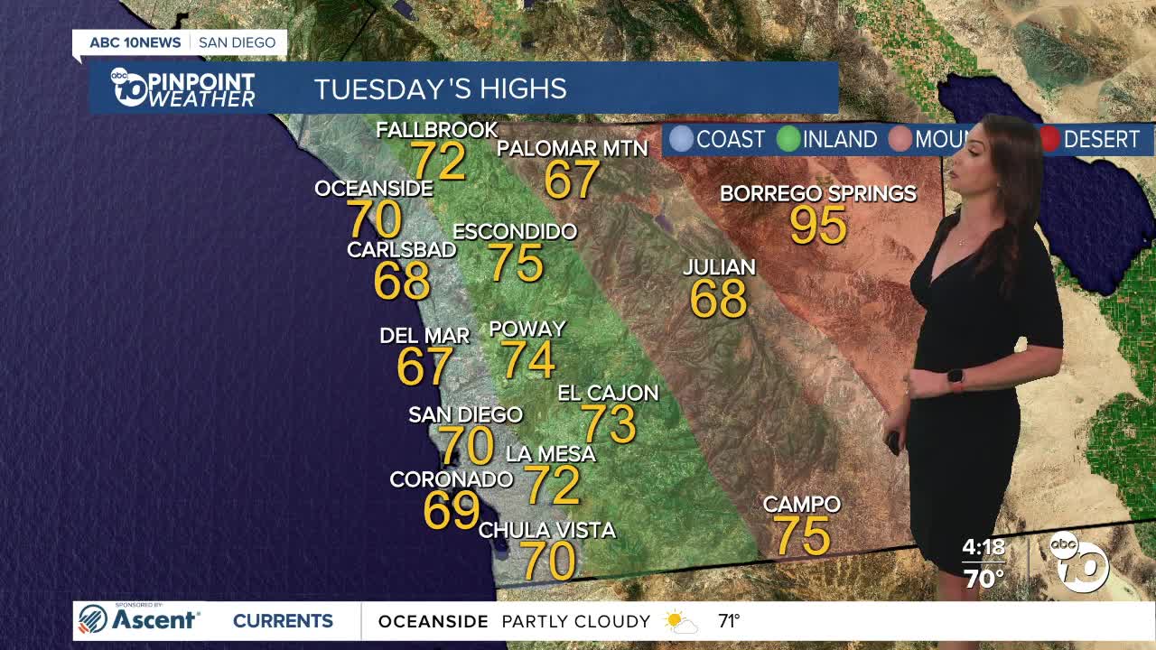
Tuesday's Highs:
Coast: 67-71°
Inland: 69-76°
Mountains: 66-75°
Deserts: 95-98°
Follow ABC 10News Meteorologist Megan Parry on Facebook at Megan Parry 10News, Instagram @mis_meg_wx and Twitter @10NewsParry.
