

Cooler weather will be the trend into the weekend, with a deepening marine layer along the coast and in the valleys. Temperatures will plummet 5 to 15 degrees below average across the county this weekend, with some mountains up to 20 degrees below normal!
A storm moving into the Pacific Northwest is what is bringing the cool-down this weekend. It will also act to deepen the marine layer with slower clearing this weekend and likely limited clearing for most coastal areas leading to more of a June Gloom pattern. Patchy drizzle will be possible overnight and in the morning hours this weekend.
The wind will pick up in the mountains and deserts each afternoon and evening through Sunday with winds peaking on Saturday. You can expect westerly winds of 25 to 50mph, while on Saturday, isolated gusts may exceed 50mph in the windier spots. A Wind Advisory is in effect for the deserts until 11am Sunday.
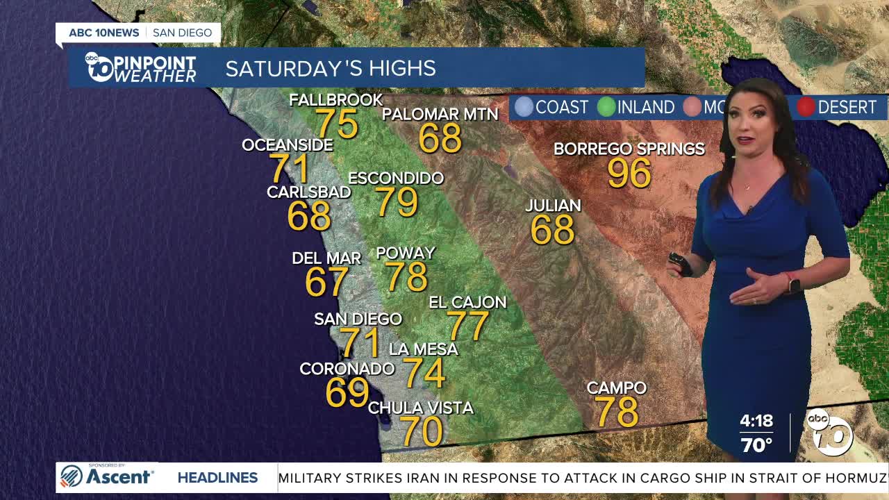
This weekend, temperatures will drop into the 60s for the coast and mountains, 70s inland, and 90s in the deserts. Slight warming with better clearing of the marine layer next week, but temperatures will remain below average all week.
By Friday next week we'll see 70s for the coast and mountains, 80s inland and 100s return to the deserts.
Saturday's Highs:
Coast: 67-72°
Inland: 70-79°
Mountains: 67-78°
Deserts: 94-99°
Follow ABC 10News Meteorologist Megan Parry on Facebook at Megan Parry 10News, Instagram @mis_meg_wx and Twitter @10NewsParry.
