

Cooler weather will be the trend into the weekend, with a deepening marine layer along the coast and in the valleys. Temperatures drop near to 5 degrees below average Thursday, except in the deserts, where it will remain hot.
The Extreme Heat Warning remains in effect in the deserts until 8pm Thursday for highs between 105 to 110 degrees.
Elevated surf continues at the coast for one more day with a Beach Hazards Statement until 10pm Thursday for waves of 3 to 6 feet and strong rip currents.
Humidity will taper off starting Thursday, though the marine layer will keep things a little muggier along the coast.
It will be breezy to gusty in the mountains and deserts each afternoon and evening Thursday through the weekend with winds peaking on Saturday. Thursday and Friday you can expect westerly winds of 25 to 50mph while Saturday isolated gusts may exceed 60mph in the windier spots.
A storm will move into the Northwest this weekend, bringing a cooling trend locally, with highs dropping 5 to 15 degrees below average.
Temperatures will drop into the 60s for the coast and mountains, low to mid-70s in the inland areas, and 90s in the deserts.
The marine layer will spread farther inland each day into the weekend, taking longer to clear. Most areas will still clear to sunny skies by mid to late morning Thursday and Friday, but June Gloom is likely for most coastal areas on Saturday and even some inland areas. That trend may linger into Sunday with better clearing next week.
Patchy drizzle will be possible out of marine layer clouds in the overnight and morning hours this weekend.
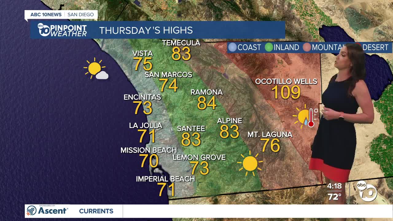
Thursday's Highs:
Coast: 70-75°
Inland: 73-84°
Mountains: 75-88°
Deserts: 105-109°
Follow ABC 10News Meteorologist Megan Parry on Facebook at Megan Parry 10News, Instagram @mis_meg_wx and Twitter @10NewsParry.
