

High pressure coupled with the monsoon flow will bring warmer and muggier days through Wednesday. Temperatures will top out near to 5 degrees above average, while the higher humidity will make things feel warmer.
There is a slight chance of sprinkles, a stray shower, or even a lightning strike in the mountains.
Temperatures will surge in the deserts up to 110 degrees where an Extreme Heat Warning is in effect from 11am Wednesday through 8pm Thursday.
If headed to the beaches, be prepared for elevated surf with a Beach Hazards Statement in effect until 10pm Thursday for waves of 3 to 6 feet and strong rip currents.
Through Friday, you can expect 70s at the coast, 80s and some 70s inland and in the mountains, and between 105 and 110 in the deserts.
Humidity will taper off starting Thursday, though the marine layer will keep things a little muggier along the coast.
A storm will move into the Northwest this weekend, bringing a cooling trend locally. We'll see 70s across most of the county this weekend, 60s for the cooler coastal spots, with temperatures dropping into the 90s in the deserts. The marine layer will also spread farther inland and take longer to clear.
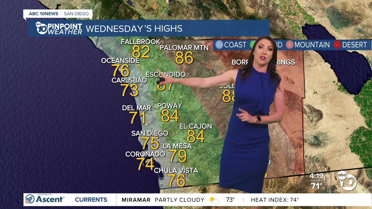
Wednesday's Highs:
Coast: 70-77°
Inland: 76-88°
Mountains: 85-93°
Deserts: 107-110°
Follow ABC 10News Meteorologist Megan Parry on Facebook at Megan Parry 10News, Instagram @mis_meg_wx and Twitter @10NewsParry.
