

The marine layer will be shallower on Wednesday, which means fog is more likely, especially away from the immediate coast. Clouds will give way to sunny skies by mid to late morning with warm temperatures by the afternoon.
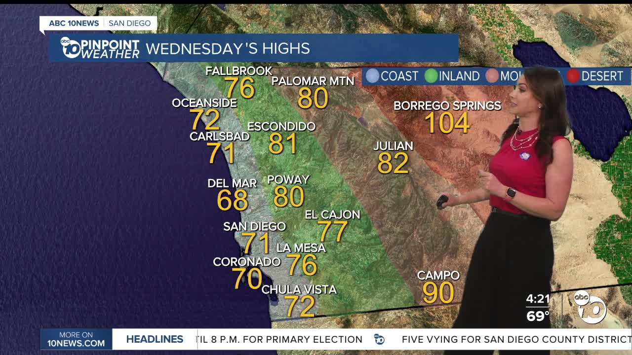
The marine layer won't spread as far inland on Wednesday and Thursday as high pressure builds. These will also be the warmest days of the week, with mostly 70s along the coast, mid-70s to mid-80s for inland and mountain communities, and around 104 to 108 in the deserts.
A trough of low pressure (a storm) will move into the Pacific Northwest this weekend, deepening the marine layer locally and bringing a cool-down.
This weekend, you can expect slower clearing of the marine layer for the coast and valleys, with temperatures dropping mostly into the 60s at the coast, 70s inland to the mountains, and 90s returning by Sunday in the deserts.
The storm track will remain active in the Northwest into next week, continuing to influence our marine layer. Temperatures look to trend near average through at least mid-next week, with morning clouds clearing to sunny skies.
Wednesday's Highs:
Coast: 68-74°
Inland: 73-83°
Mountains: 80-90°
Deserts: 103-106°
Follow ABC 10News Meteorologist Megan Parry on Facebook at Megan Parry 10News, Instagram @mis_meg_wx and Twitter @10NewsParry.
