

A touch warmer Thursday with temperatures trending near to 7 degrees above average. Patchy low clouds and fog will clear through the morning, but high clouds will build late in the day as a surge of subtropical moisture moves in.
While these clouds will make for a nice sunset, it's also going to be pumping in higher humidity that will stick around through the weekend.
Friday through Sunday will be the warmest days, up to 10 degrees above average, as high pressure from the Pacific builds over the west. Expect temperatures in the mid-70s at the coast while the warmest spots will near 80, mid-80s to low-90s inland and in the mountains, and around 110 degrees in the deserts.
The biggest surge of subtropical moisture arrives on Friday, bringing more clouds and a slight chance of sprinkles to a few stray showers. While the mountains have a slightly better chance of a little rain, there's a small chance anywhere in the county.
With warmer days and higher humidity, overnight temperatures will also warm. While daily record highs don't look likely, we may set some record-high minimum temperatures Friday and Saturday mornings. Most of the county will only cool into the mid-60s by sunrise, with 70s in the deserts.
If headed to the beaches to beat the heat, be prepared for elevated surf and strong rip currents. A Beach Hazards Statement is in effect until 5pm Thursday for waves of 4 to 7 feet and sets to 9 feet.
The humid air will get pushed east next week and the marine layer will spread farther inland, cooling the coast and valleys back to seasonal temperatures, but the mountains and deserts will remain quite warm.
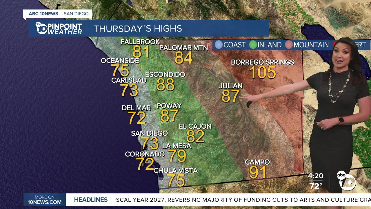
Thursday's Highs:
Coast: 70-78°
Inland: 78-88°
Mountains: 83-91°
Deserts: 105-108°
Follow ABC 10News Meteorologist Megan Parry on Facebook at Megan Parry 10News, Instagram @mis_meg_wx and Twitter @10NewsParry.
