

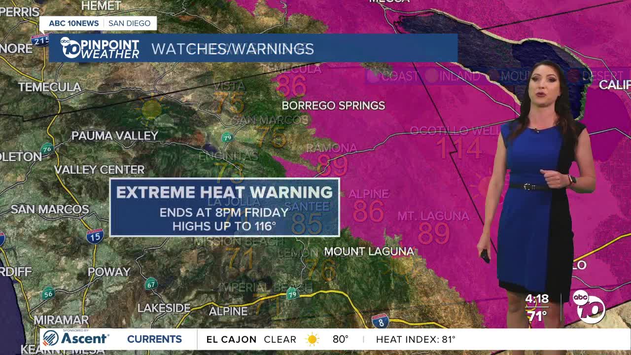


The marine layer will spread farther inland by Friday morning with patchy fog for the coast and valleys for the commute. The marine layer will keep temperatures more comfortable for the coast and valleys Friday, with temperatures trending near average. The mountains and deserts, however, have one more day of above-normal temperatures.
High temperatures will run 3 to 8 degrees above average for inland, mountain, and desert communities. Along the coast, the marine layer will help keep conditions more comfortable, with highs mainly in the 70s.
The Extreme Heat Warning in the deserts continues until 8pm Friday for highs up to 116 degrees.
The Heat Advisory for the mountains also ends at 8pm Friday for highs mostly in the 90s, but some lower elevations, like Campo, will get close to 100 degrees.
Temperatures will drop this weekend back near average with 70s for the coast, 80s inland and mountains and below 110 degrees in the deserts, but humidity will be going up.
Looking ahead to the weekend, monsoon moisture will begin moving into Southern California, increasing humidity across the region. There will also be a slight chance of sprinkles or isolated showers, mainly near the mountains, with even a small possibility of a pop-up thunderstorm. That chance of storms increases near the mountains and deserts next week with the potential for isolated to scattered storms that may produce flash flooding.
As of right now there is a slight chance of showers and thunderstorms Sunday, isolated storms are a bit more likely on Monday. The chance of storms lowers Tuesday and Wednesday, though it will still be humid. The chance of storms ramps up again for the end of the week into next weekend as a tropical system pumps in even more moisture.
While it won't be as hot this weekend, temperatures go back up next week with 90s returning inland and in the mountains and nearing 80 degrees at the coast. That means it will be hot AND humid next week. This stretch of high humidity, hot temperatures, and monsoon storms may stick around through the end of the month.
Stay with the Pinpoint Weather Team as we track this hot and humid summer weather.
If headed to the beaches to beat the heat, high tides peaking just over 7 feet are forecast Sunday through Tuesday, leading to possible coastal flooding of low-lying areas, boardwalks, and beach parking lots. Dangerous rip currents will also be possible.
Friday's Highs:
Coast: 70-75°
Inland: 76-89°
Mountains: 87-98°
Deserts: 111-115°
Tips to Stay Safe in the Heat this Summer: Excessive heat is a danger to anyone, especially those with respiratory issues, people who work outdoors, children and the elderly. Make sure outdoor pets have safe shelter and cool water. Cars turn into ovens in a matter of minutes so be sure to check the back seat and never leave children or pets in the car. Wear light-weight, light-colored, loose-fitting clothing and stay hydrated! Avoid strenuous outdoor activities, enjoy air conditioning whenever possible and if you're working in the heat make sure to take breaks often and drink plenty of water.
Now is a good time to check your cars for loose tire tread or parts—anything that could easily spark a fire. In addition, make sure you have a go bag and working flashlights in case of an emergency or power outage. Also, prune and trim trees and shrubs to make a defensible space around your home.
Follow ABC 10News Meteorologist Megan Parry on Facebook at Megan Parry 10News, Instagram @mis_meg_wx and Twitter @10NewsParry.
