

Clouds will continue to spread across the county into the 4th of July, driven by subtropical moisture from post-tropical cyclone Douglas churning hundreds of miles west of Cabo.
It will be a warm and muggy 4th of July, though temperatures will be trending close to average across the county. While not likely, a few sprinkles can't be ruled out as moisture surges in, with the best chance near the mountains.
You can expect partly cloudy to mostly cloudy skies across the county Saturday, but clouds will be above the fireworks shows, so no need to worry about a blocked view.
This 4th of July, there are several parades and festivals across the county! Mid-morning during the parades, you can expect low-70s at the coast with mid to upper-70s inland to the mountains.
Afternoon highs will be in the low to mid-70s at the coast, low to upper-80s inland, mostly low-80s in the mountains, and between 104 and 108 in the deserts.
Temperatures during the fireworks shows across the county will be quite mild, in the mid to upper-60s along the coast, with mid-60s to low-70s inland to the mountains, while it will be hot in the deserts in the 90s.
High pressure will build next week, bringing warmer temperatures, trending above normal for the mountains and deserts, while the marine layer will help keep temperatures for the coast and valleys near average.
Dangerous heat will impact the deserts with highs soaring above 110 degrees most of next week.
By next weekend, high pressure will strengthen even more, bringing even hotter temperatures across the county. On top of the heat, it's likely that monsoon moisture will also move in, making things more humid and may bring a chance of mountain storms.
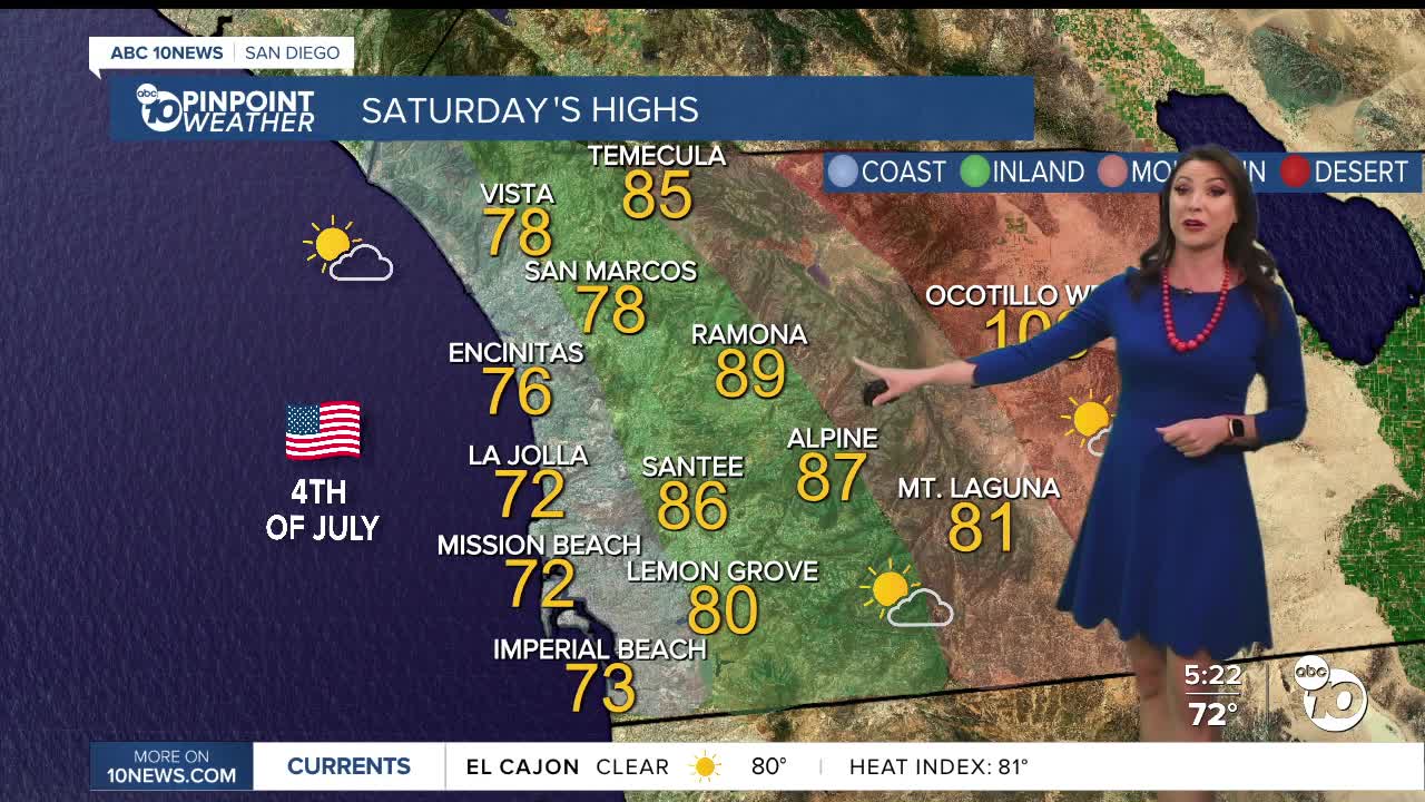
Saturday's Highs:
Coast: 70-77°
Inland: 78-89°
Mountains: 80-90°
Deserts: 103-108°
Follow ABC 10News Meteorologist Megan Parry on Facebook at Megan Parry 10News, Instagram @mis_meg_wx and Twitter @10NewsParry.
