

The marine layer won't extend as far inland Friday into the weekend, but high clouds will be streaming in by Friday afternoon from subtropical moisture from Tropical Cyclone Douglas churning hundreds of miles west of Cabo.
You can expect partly cloudy to mostly cloudy skies across the county Friday and Saturday, but clouds will be above the fireworks shows, so no need to worry about a blocked view.
This 4th of July, there are several parades and festivals across the county! Mid-morning during the parades, you can expect low-70s at the coast with mid-70s inland to the mountains. Afternoon highs will be in the low to mid-70s at the coast, low to mid-80s inland, upper-70s to low-80s in the mountains, and between 104 and 108 in the deserts.
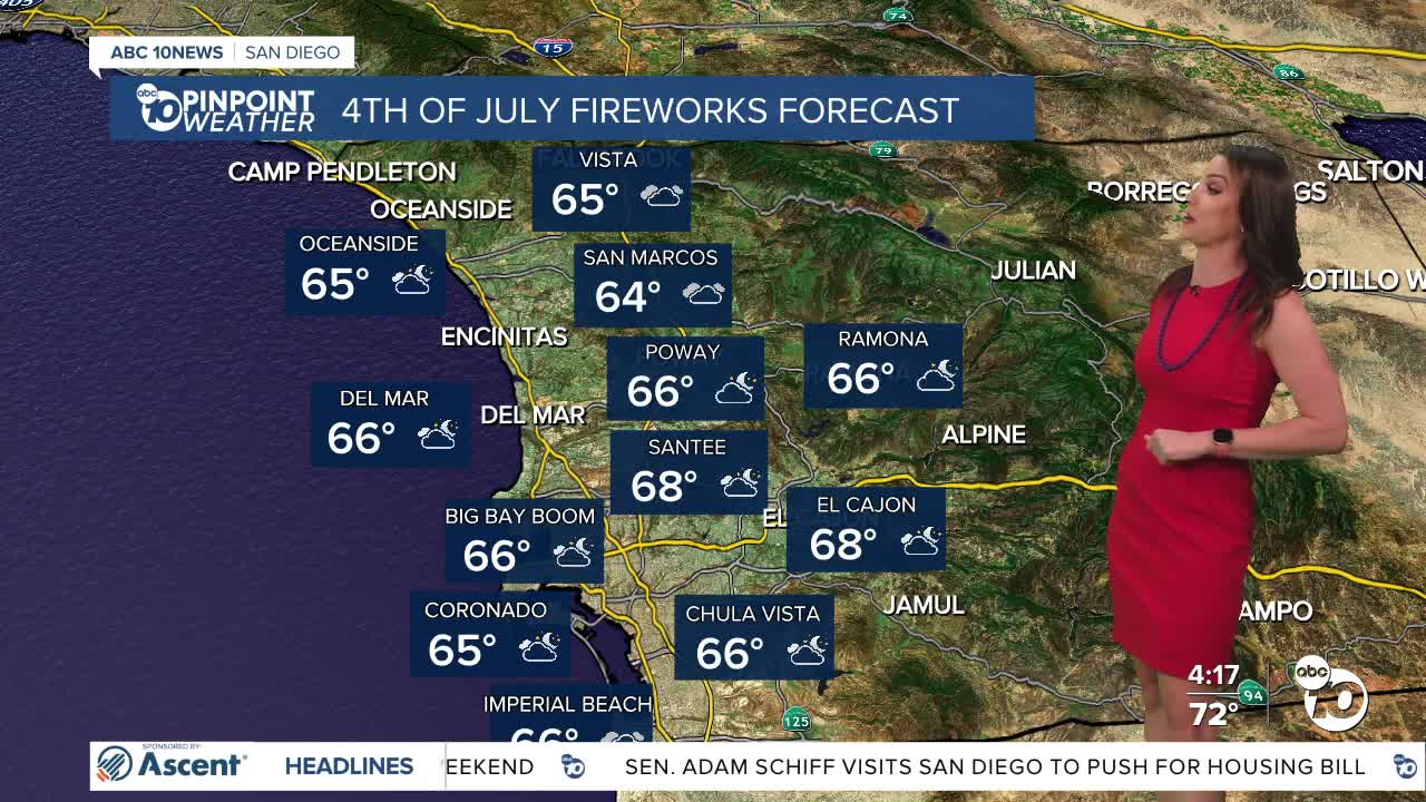
Temperatures during the fireworks shows across the county will be quite mild, in the mid-60s for nearly all coastal, inland, and mountain communities, while it will be hot in the deserts at 90s.
High pressure, which is bringing extreme heat to so much of the eastern half of the country, will start to expand west this weekend and even more so next week. This will bring warmer weather locally, though extreme temperatures aren't expected for most of the county. The deserts will experience elevated heat risk next week with around 110 degrees.
Warmer weather will stick around into next week, and by next weekend we may get a surge of monsoon moisture, adding higher humidity and perhaps a chance of mountain storms.
Friday's Highs:
Coast: 70-75°
Inland: 75-85°
Mountains: 77-89°
Deserts: 103-106°
Follow ABC 10News Meteorologist Megan Parry on Facebook at Megan Parry 10News, Instagram @mis_meg_wx and Twitter @10NewsParry.
