



Weather headlines:
- Hot and humid all week
- Heat Advisory for the coast and Extreme Heat Warning for the inland, mountains and deserts end at 8pm Thursday.
- Slight chance of showers and thunderstorms over the mountains and deserts.
- Get ready! This stretch of hot and humid weather with monsoon storms may linger through the rest of the month.
- Beach Hazards Statement through Wednesday night for high tides, minor coastal flooding, and strong rip currents.
Wednesday is the hottest day of the week with most inland and mountain areas warming into the 90s while Escondido, Ramona and Campo soared into the 100s while the deserts hit 116 degrees.
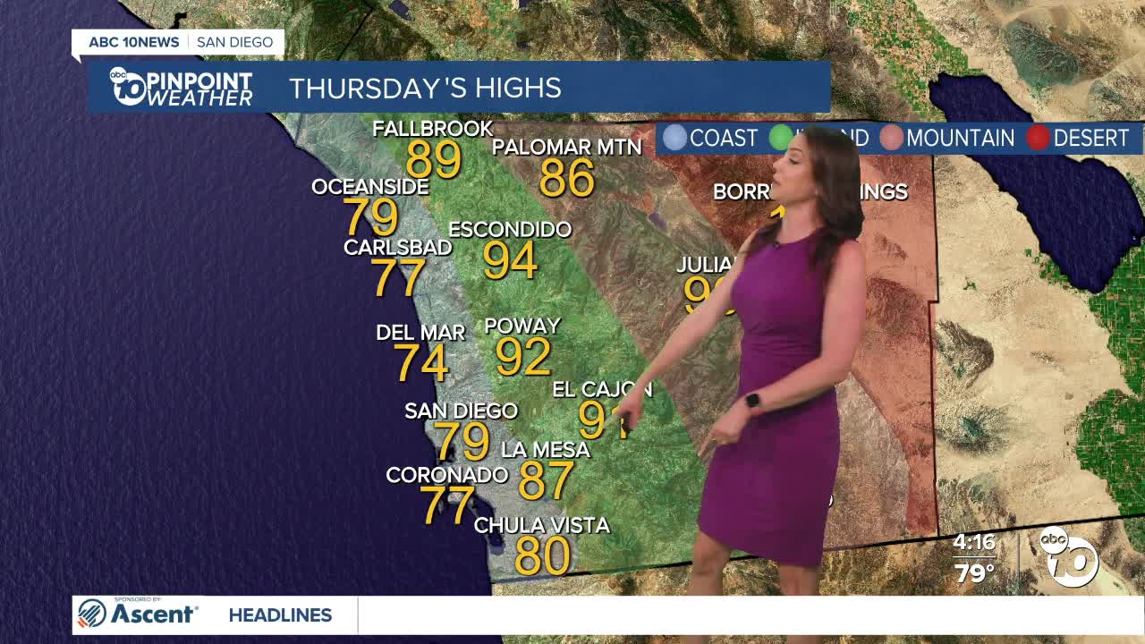
An Extreme Heat Warning is in effect for the inland and mountain communities until 8pm Thursday. Highs will mostly be in the 90s, but some of the hotter spots may hit the triple digits.
An Extreme Heat Warning for the desert is also in effect until 8pm Thursday, with highs up to 114 degrees.
A Heat Advisory for the coast will also end at 8pm Thursday. Temperatures will trend in the mid-70s to low-80s at the beaches, but heading 5 to 10 miles inland, we'll see 90s.
On top of the heat, it's also humid as monsoon moisture continues to pump in high humidity across the county. The chance of showers and thunderstorms increases slightly over the mountains and deserts Thursday and Friday as a surge of moisture comes in from the east. This will also bring increasing clouds across the county by the afternoon.
As long as monsoon flow continues, which may be through the end of the month, there is at least a slight chance of showers and thunderstorms over the mountains. Any storms that form may produce heavy rain, gusty winds, and small hail.
Next week, Tropical Cyclone Elida will pass hundreds of miles to the west, but will pump in higher humidity from the west. That, coupled with monsoon flow from the east, will bring even higher humidity and a potentially greater chance of showers and thunderstorms, even along the coast and in the valleys.
4 p.m. video update of the Thorn Fire and tracking Tropical Storm Elina, bringing more moisture next week:
On top of the hot days, the nights will be significantly warmer through Friday morning. Most of the night will be spent in the 70s at the coast, inland, and in mountain communities, while the deserts will only drop into the 80s by sunrise. That means the days will start off on a warmer note, with little relief overnight, making the entire day feel hotter and more uncomfortable, especially for those without air conditioning.
Tuesday night brought coastal flooding to some areas of Mission Beach and Pacific Beach from the king tides. While the tides won't be quite as high tonight, the threat for flooding continues as a Beach Hazards Statement is in effect until midnight Wednesday. The highest tides will be during the evening high tide at 10:25pm Wednesday.
Stay with the Pinpoint Weather Team as we track this hot and humid summer weather
Thursday's Highs:
Coast: 67-71°
Inland: 68-72°
Mountains: 50-62°
Deserts: 75-78°
Tips to Stay Safe in the Heat this Summer: Excessive heat is a danger to anyone, especially those with respiratory issues, people who work outdoors, children and the elderly. Make sure outdoor pets have safe shelter and cool water. Cars turn into ovens in a matter of minutes so be sure to check the back seat and never leave children or pets in the car. Wear light-weight, light-colored, loose-fitting clothing and stay hydrated! Avoid strenuous outdoor activities, enjoy air conditioning whenever possible and if you're working in the heat make sure to take breaks often and drink plenty of water
Now is a good time to check your cars for loose tire tread or parts—anything that could easily spark a fire. In addition, make sure you have a go bag and working flashlights in case of an emergency or power outage. Also, prune and trim trees and shrubs to make a defensible space around your home.
Follow ABC 10News Meteorologist Megan Parry on Facebook at Megan Parry 10News, Instagram @mis_meg_wx and Twitter @10NewsParry.
