

This rain is like a kid who refuses to go to sleep -- stubborn. We have more to wrap up the weekend and start the work week, but there is relief in sight!
The bulk of the activity will happen Sunday evening, followed by another round near midnight.
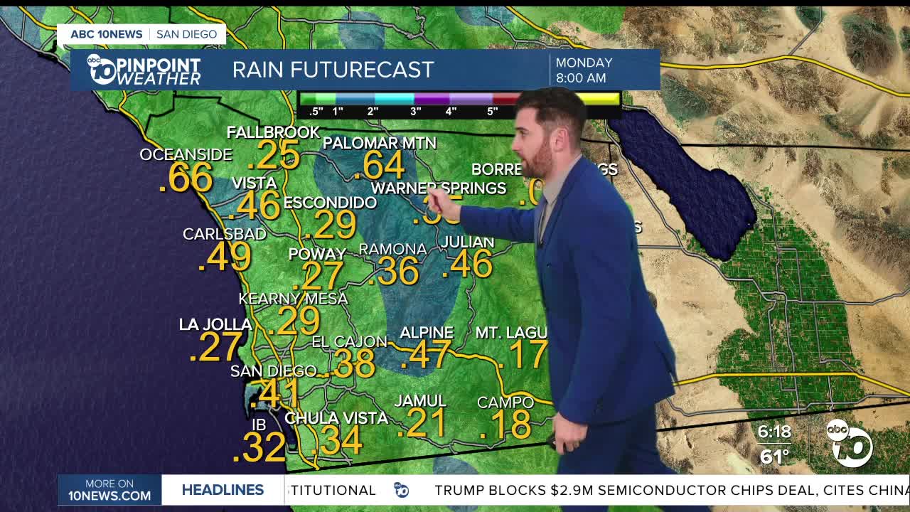
Here are some totals already for Sunday by 11p:
Palomar Mountain: 1.67"
Fallbrook: 0.72"
Vista: 0.40"
San Marcos: 0.23"
Escondido: 0.17"
San Diego: 0.08"
By Monday morning, there's a potential to add 0.25"-0.50" more of rain to those totals, except in the deserts where minimal amounts are expected.
This means we still have the potential to see some flooding in areas prone to those conditions.
Winds have also been whipping in the mountains and deserts, with gusts peaking around 40-50 mph, but that should weaken during the day Monday.
We could see more showers as well, with spots inland and in the mountains looking to possibly receive a sprinkle or two in the afternoon, but if it does fall, it wouldn't be much.
We're looking at partly cloudy to mostly cloudy skies, with fog also hitting the valleys and mountains. Temperatures will also be below average by up to 5 degrees across the board.
The same goes for Tuesday, although chances for showers are even slighter.
By Wednesday it appears we will be in the clear. Mostly sunny skies are back in the forecast through at least next Sunday.
Temperatures will also start to gradually warmup during that stretch, with everyone back to at-or-above average levels by Thursday, and only increasing from thereon out.
Monday's Highs:
Coast: 62-64°
Inland: 59-67°
Mountains: 45-57°
Deserts: 64-71°
Follow ABC 10News Weather Anchor Max Goldwasser on Instagram, Facebook and Twitter.
