

Gorgeous sunset Tuesday as clouds spread across the county. Those clouds will continue through Wednesday with mostly to partly cloudy skies. Those clouds will keep temperatures from getting as cold by Wednesday morning with most areas in the 40s by sunrise, rather than so many 30s and even some 20s like Tuesday morning.
Temperatures will trend near to 6 degrees above average Wednesday, becoming even warmer Thursday through Sunday, with highs soaring 10 to 15 degrees above average! High pressure building over the west, coupled with weak to mild Santa Ana winds, will lead to the warm-up.
Expect east and northeasterly winds of 20 to 45mph inland to the mountains Thursday through Saturday.
Expect 70s and 80s for most of the county and 60s in the mountains Thursday through the weekend.
The sea-breeze returns Sunday leading to recovering humidity. There is a potential for a moderate to strong Santa Ana wind event mid to late next week.
As far as rain, there are hints that we may get rain mid-February, around the 10th; but that is so far out, confidence is low.
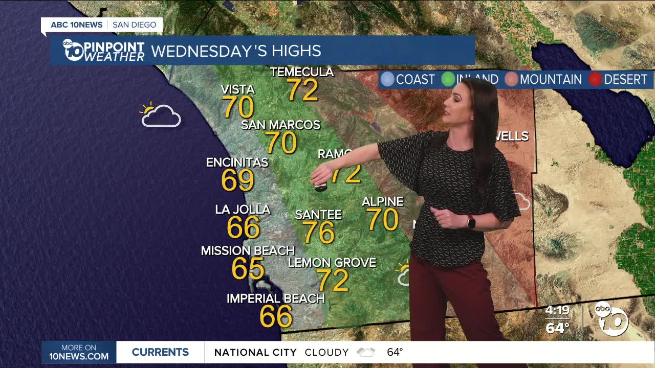
Wednesday's Highs:
Coast: 65-70°
Inland: 72-76°
Mountains: 53-69°
Deserts: 72-74°
Follow ABC 10News Meteorologist Megan Parry on Facebook at Megan Parry 10News, Instagram @mis_meg_wx and Twitter @10NewsParry.
