

A storm passing south through Baja will continue a slight chance of light, isolated showers into Saturday. The coast will mostly have patchy drizzle into Saturday morning with inland and mountain areas have a slight chance of a few stray showers into Saturday afternoon. Any rainfall accumulations will be light, a few hundredths to a tenth of an inch.
Rainfall totals so far have been unimpressive, with the higher totals reported at Palomar Mountain, Ramona, and Valley Center picking up .12 to .15" of rain.
Click here to see real-time rainfall totals where you live.
This storm won't be a big wind maker but it will be breezy in the mountains and deserts as the storm exits on Saturday. Expect west and northeasterly gusts of 30 to 50mph.
The winds turn offshore with mild Santa Ana winds Sunday into Monday with northeasterly winds of 25 to 45mph for the inland and mountain areas.
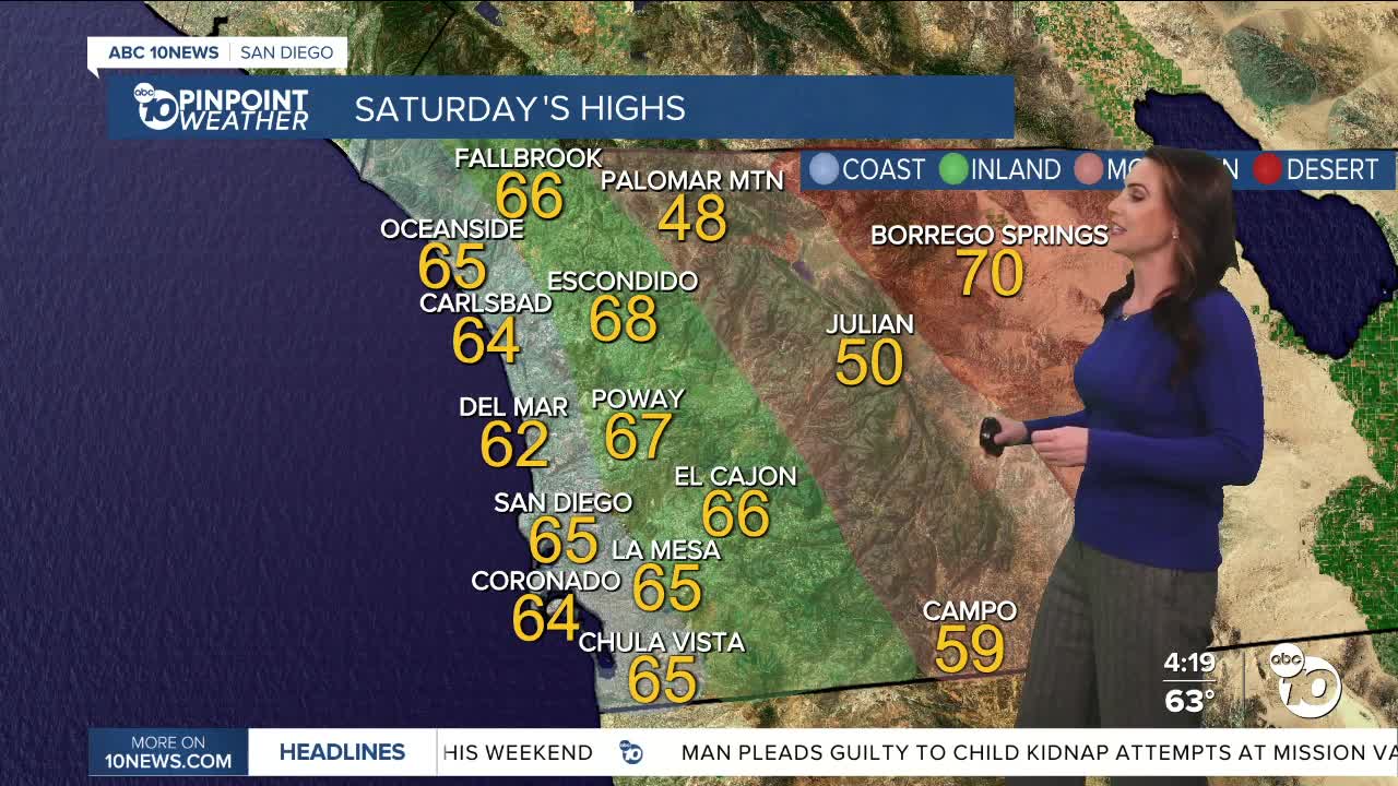
It will be cooler through Sunday with temperatures trending near to 5 degrees below average. Expect 60s for most coast and valleys, 40s and 50s in the mountains, and upper-60s to low-70s in the deserts.
Temperatures rebound next week, back near average by Monday with slight warming for the end of the week. Expect 60s and 70s for most of the county and 50s in the mountains.
There will be a series of storms passing to the north, which will bring passing clouds to San Diego into next week. There is a slight chance of showers by Thursday, but the storm track is uncertain this far out, as it may track farther east, which would bring us another round of Santa Ana winds instead of rain.
Saturday's Highs:
Coast: 60-66°
Inland: 60-68°
Mountains: 47-59°
Deserts: 70-72°
Follow ABC 10News Meteorologist Megan Parry on Facebook at Megan Parry 10News, Instagram @mis_meg_wx and Twitter @10NewsParry.
